Trek Zone

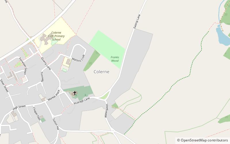
Frank's Wood, Colerne

Nr. 2 unter den Attraktionen in Colerne

Natürliche Anziehungskraft, Wald
Frank's Wood location map
Karte

Fakten und Informationen

Frank's Wood ist ein Waldgebiet in Wiltshire, England, in der Nähe des Dorfes Colerne. Es umfasst eine Gesamtfläche von 1,92 Hektar. Es befindet sich im Besitz des Woodland Trust und wird von diesem verwaltet.

Koordinaten: 51°26'24"N, 2°15'22"W
Adresse

Colerne Großbritannien

KontaktHinzufügen
Soziale Medien
Hinzufügen
Tagesausflüge

Frank's Wood – beliebt in der gegend (entfernung vom objekt)

In der Nähe befinden sich unter anderem Attraktionen wie: Recreation Ground, Cumberwell Park, Corsham Court, St Catherine's Court.

  • recreation ground bath5.8 miSW
  • cumberwell park bradford on avon5 miS
  • corsham court3.2 miE
  • st catherines court cotswold water park2.9 miW
  • browns folly cotswold water park3.7 miSW
  • rondo theatre bath4.9 miSW
  • church of st john the baptist cotswold water park3.5 miSW
  • bath skyline5.7 miSW
  • hungerford almshouses corsham3.2 miE
  • corsham limestone formation location map
    2.6 miSE
  • church of st catherine cotswold water park2.9 miW

Wohin als nächstes? Gehen Sie auf die Seite der Region england England oder sehen Sie sich alle Orte und Sehenswürdigkeiten in Großbritannien an.