Trek Zone

Glen Dochart, Loch-Lomond-and-the-Trossachs-Nationalpark

Nr. 100 unter den Attraktionen in Loch-Lomond-and-the-Trossachs-Nationalpark

Natur, Natürliche Anziehungskraft, Tal
Glen Dochart location map
Karte

Fakten und Informationen

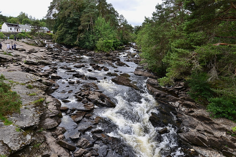
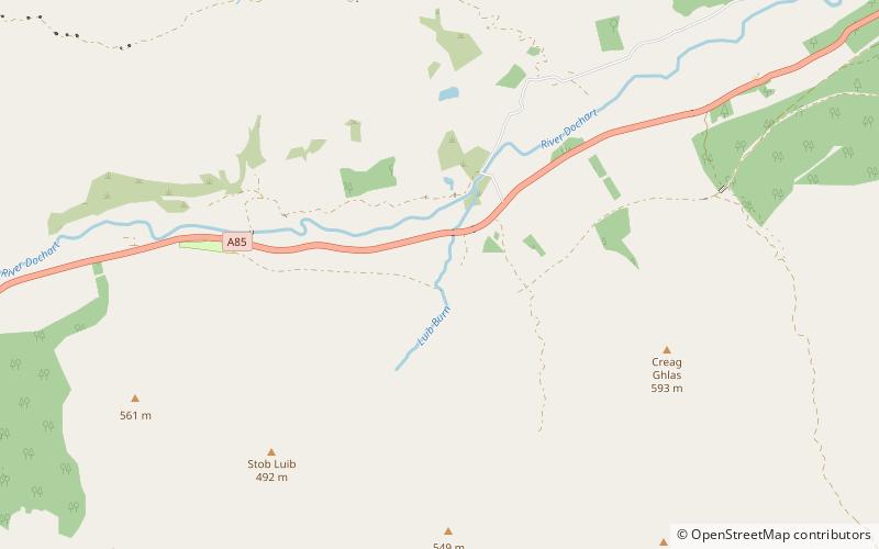
Glen Dochart in Perthshire in den schottischen Highlands ist ein Tal, das von Crianlarich in östlicher Richtung nach Killin verläuft und dem Lauf des Flusses Dochart folgt, der durch Loch Dochart und Loch Iubhair fließt. Bei Lix Toll trifft er auf das Glen Ogle. Lochan Saorach liegt in diesem Glen und war einst für seine schwimmende Insel berühmt.

Koordinaten: 56°25'1"N, 4°25'59"W
Adresse

Loch-Lomond-and-the-Trossachs-Nationalpark Großbritannien

KontaktHinzufügen
Soziale Medien
Hinzufügen
Tagesausflüge

Glen Dochart – beliebt in der gegend (entfernung vom objekt)

In der Nähe befinden sich unter anderem Attraktionen wie: Falls of Dochart, Ben More, Glen Ogle, Stob Binnein.

  • falls of dochart killin5.3 miNE
  • ben more crianlarich4.6 miSW
  • glen ogle loch lomond and the trossachs nationalpark4.6 miE
  • stob binnein loch lomond and the trossachs nationalpark5.1 miSW
  • lochan saorach loch lomond and the trossachs nationalpark3 miW
  • cruach ardrain loch lomond and the trossachs nationalpark6.9 miSW
  • meall an t seallaidh balquhidder3.7 miSE
  • loch voil loch lomond and the trossachs nationalpark4.8 miS
  • moirlanich longhouse killin5.6 miNE
  • meall glas5.1 miNW
  • sgiath chuil loch lomond and the trossachs nationalpark3.4 miNW

Wohin als nächstes? Gehen Sie auf die Seite der Region schottland Schottland oder sehen Sie sich alle Orte und Sehenswürdigkeiten in Großbritannien an.