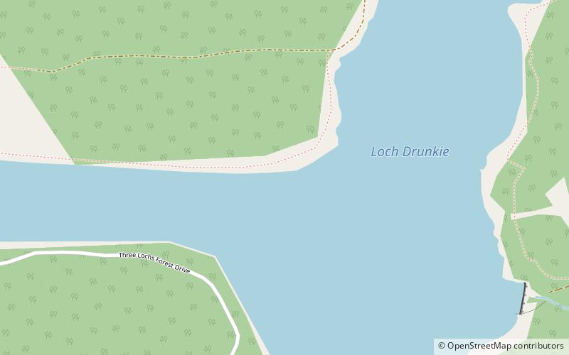
Loch Drunkie, Loch-Lomond-and-the-Trossachs-Nationalpark

Galerie (1)
Karte
Karte
Fakten und Informationen
Loch Drunkie ist ein kleiner Süßwassersee am Südrand der schottischen Highlands in der Council Area Stirling. Er liegt nur 400 m südwestlich von Loch Venachar und circa neun Kilometer westlich von Callander im Loch Lomond and the Trossachs National Park. ()
Andere Namen: Länge: 5249 ftBreite: 1312 ftMaximale Tiefe: 97 ftHöhe: 463 ft ü. d. M.Koordinaten: 56°12'35"N, 4°21'5"W
Adresse
Loch-Lomond-and-the-Trossachs-Nationalpark
KontaktHinzufügen
Soziale Medien
Hinzufügen
Tagesausflüge