Stirling Sill, Stirling
Fakten und Informationen
Die Stirling Sill ist ein Aufschluss einer großen Quarz-Dolerit-Intrusion oder -Schwelle, die einen großen Teil von Zentralschottland unterlagert und in großer Tiefe zusammenhängend sein kann. Die Schwelle ist aus dem späten Karbon oder wahrscheinlicher aus dem Perm, da sie die Kohleflöze durchdringt, oft in den Schichtflächen zwischen den verschiedenen Schichten. An manchen Stellen steigt sie durch Brüche in den Schichten auf eine neue Ebene und bildet Merkmale, die man an der Oberfläche als Deiche bezeichnen würde.
An ihrem Ausbruch im Westen liegt die Schwelle im Allgemeinen an der Basis der Karbonabfolge und direkt über den kalkhaltigen Sandsteinablagerungen und Laven, wie man im oberen Teil des Tals des Bannock Burn sehen kann. Zum Leidwesen der Bergleute liegt sie jedoch in den nutzbaren Schichten im Osten höher und hat an einigen Stellen die Kohle zerstört, während sie an anderen Stellen dazu geführt hat, dass die Kohle in wertvolleren Anthrazit umgewandelt wurde.
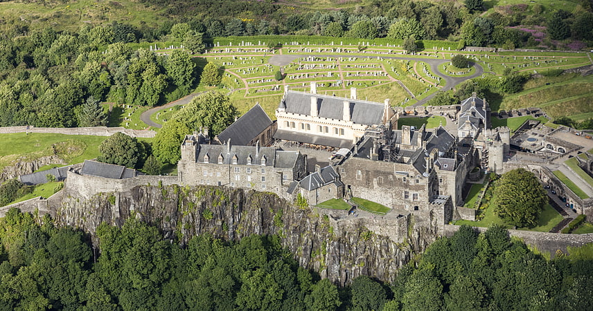
Die Neigung des Abbey Craig oder des Stirling Castle-Felsens gibt einen Überblick über den Neigungswinkel der Kohleflöze im äußersten Teil des Kohlereviers, und auch die Mächtigkeit der Schwelle, die etwa 100 Meter beträgt, ist zu erkennen.
Geologen haben verschiedene Theorien über die Entstehung von Anthrazit aufgestellt, da die Kohle in der Nähe der Ochil-Verwerfung am effektivsten gebrannt wurde, doch sind die Theorien nicht unbedingt unvereinbar.
Der Ursprung der Schwelle, an der das geschmolzene Gestein von unten aufstieg, ist nicht bekannt; es ist jedoch bekannt, dass es in der Ochil-Verwerfung Steigleitungen gibt, die jedoch nicht mit der Gesamtstruktur übereinstimmen. Der Hauptursprung der Schwelle könnte in der Region des eruptiven Zentrums liegen, das die Ochil Hills in einer viel früheren Periode bildete, was Geologen irgendwo östlich von Stirling, möglicherweise in der Region von Kincardine, vermuten. Dies steht im Zusammenhang mit der Absenkung nach der ersten Runde eruptiver Aktivität, die zur Bildung der Kohlebecken führte, und einem viel späteren Ausbruch intrusiver Aktivität aus denselben Magmazuführern. Die Wahrheit wird jedoch unbekannt bleiben, da sehr viele tiefe Bohrungen in hartem Gestein erforderlich wären, um die Tiefen zu sondieren und die notwendigen Beweise zu finden.
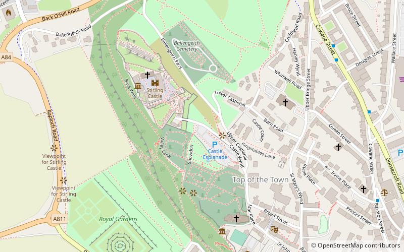
Die westlichen Enden der Schwelle sind am Abbey Craig, Stirling Castle, Kings Park, Gillies Hill, Sauchieburn und an verschiedenen Stellen im Süden zu sehen.
Der Quarz-Dolerit wurde früher an mehreren Orten abgebaut, u. a. in Cambusbarron und Murrayshall, wird aber heute in Northfield vor allem als Straßenstein abgebaut.
Stirling
- Busse
- Bahn
 Busse
Busse
- Bestimmen Sie die RouteBahnhof Stirling 13 Min. Fußweg
- Bestimmen Sie die RouteAllan Park South Church 13 Min. Fußweg
- Bestimmen Sie die RouteStirling Bus Station 15 Min. Fußweg


Häufig gestellte Fragen (FAQ)
Welche beliebten Attraktionen gibt es in der Nähe?
Wie kommt man mit öffentlichen Verkehrsmitteln dorthin?
Bahn
- Bahnhof Stirling (13 Min. Fußweg)
Busse
- Allan Park South Church • Linien: B12 (13 Min. Fußweg)
- Stirling Bus Station • Linien: 24, B12, C11, X39 (15 Min. Fußweg)