Trek Zone

Billsmoor Park and Grasslees Wood, Northumberland-Nationalpark
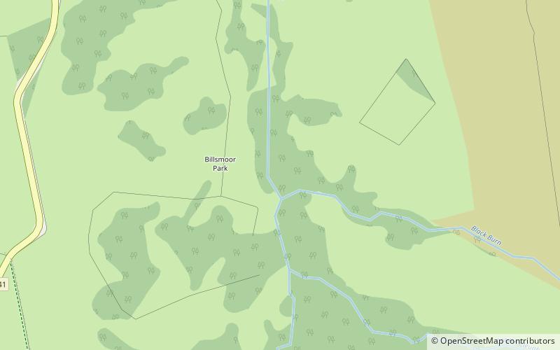
Nr. 23 unter den Attraktionen in Northumberland-Nationalpark

Natur, Natürliche Anziehungskraft, Wald
Billsmoor Park and Grasslees Wood location map
Karte

Fakten und Informationen

Billsmoor Park and Grasslees Wood ist der Name eines 1954 ausgewiesenen Gebiets von besonderem wissenschaftlichen Interesse in Northumberland, Nordostengland. Billsmoor Park ist ein ausgedehnter Erlenwald, wie er in der Grafschaft immer seltener wird; der viel kleinere Grasslees Wood ist ein Eichenwald.

Koordinaten: 55°15'42"N, 2°5'3"W
Adresse

Northumberland-Nationalpark Großbritannien

KontaktHinzufügen
Soziale Medien
Hinzufügen
Tagesausflüge

Billsmoor Park and Grasslees Wood – beliebt in der gegend (entfernung vom objekt)

In der Nähe befinden sich unter anderem Attraktionen wie: St Cuthbert's Church, Harbottle Castle, St John the Evangelist's Church, Simonside Hills.

  • st cuthberts church northumberland nationalpark2.1 miS
  • harbottle castle northumberland nationalpark5.3 miN
  • st john the evangelists church4.3 miSW
  • simonside hills northumberland nationalpark location map
    5 miE
  • elsdon tower northumberland nationalpark2 miS
  • percy cross4.7 miW
  • tosson hill northumberland nationalpark3.7 miE
  • elsdon castle northumberland nationalpark1.9 miS
  • high cove northumberland nationalpark location map
    1.1 miNE

Wohin als nächstes? Gehen Sie auf die Seite der Region england England oder sehen Sie sich alle Orte und Sehenswürdigkeiten in Großbritannien an.