Trek Zone

The Steeple, Loch-Lomond-and-the-Trossachs-Nationalpark

Nr. 91 unter den Attraktionen in Loch-Lomond-and-the-Trossachs-Nationalpark

Natur, Natürliche Anziehungskraft, Berg
The Steeple location map
Karte

Fakten und Informationen

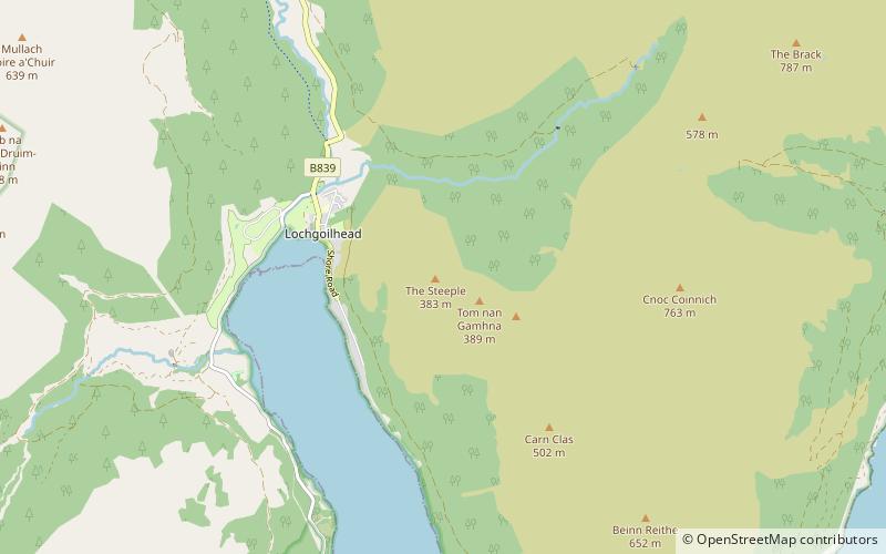
The Steeple ist ein kleiner Berg in den Ardgoil Peninsula and Arrochar Alps hinter dem Dorf Lochgoilhead im Loch Lomond and the Trossachs National Park. Der Gipfel erreicht eine Höhe von 378m.

Koordinaten: 56°10'3"N, 4°52'60"W
Adresse

Loch-Lomond-and-the-Trossachs-Nationalpark Großbritannien

KontaktHinzufügen
Soziale Medien
Hinzufügen
Tagesausflüge

The Steeple – beliebt in der gegend (entfernung vom objekt)

In der Nähe befinden sich unter anderem Attraktionen wie: Ben Arthur, Carrick Castle, Ben Donich, Stob an Eas.

  • ben arthur tarbet4.3 miNE
  • carrick castle loch lomond and the trossachs nationalpark4.1 miS
  • ben donich loch lomond and the trossachs nationalpark2.1 miN
  • stob an eas4.3 miNW
  • stob na boine druim fhinn2.8 miW
  • cnoc coinnich loch lomond and the trossachs nationalpark1.4 miE
  • beinn bheula loch lomond and the trossachs nationalpark3.8 miSW
  • the brack loch lomond and the trossachs nationalpark2.5 miNE
  • beinn lochain3.1 miW
  • finnart oil terminal4.1 miSE
  • loch goil2.7 miS

Wohin als nächstes? Gehen Sie auf die Seite der Region schottland Schottland oder sehen Sie sich alle Orte und Sehenswürdigkeiten in Großbritannien an.