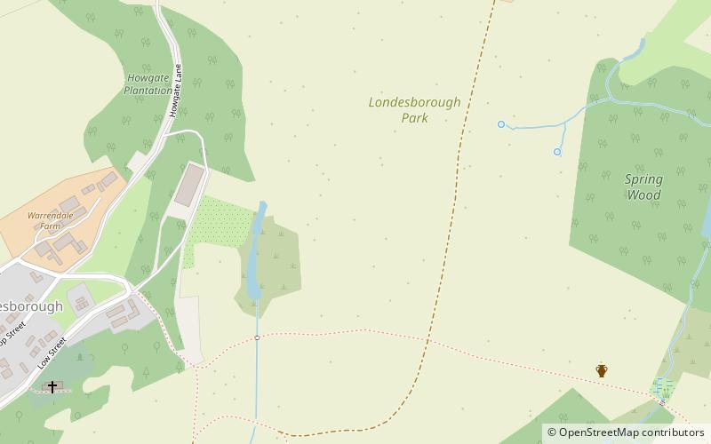
Trek Zone

Londesborough Hall

Nr. 4224 in der Beliebtheitsskala in Großbritannien

Park, Entspannen im Park
Londesborough Hall location map
Karte

Fakten und Informationen

Londesborough Hall ist ein Landhaus im Dorf Londesborough im East Riding of Yorkshire, England, in der Nähe der Städte Market Weighton und Pocklington.

Das ursprüngliche elisabethanische Gebäude wurde 1819 abgerissen und durch das heutige viktorianische Haus ersetzt.

Höhe: 236 ft ü. d. M.Koordinaten: 53°53'59"N, 0°40'20"W
Lokalisierung

EnglandGroßbritannien

Kontakt
Soziale Medien
Tagesausflüge

Londesborough Hall – beliebt in der gegend (entfernung vom objekt)

In der Nähe befinden sich unter anderem Attraktionen wie: Hudson Way, Burnby Hall Gardens, Church of All Saints, St James' Church.

  • hudson way market weighton2.4 miS
  • burnby hall gardens pocklington4.6 miNW
  • church of all saints pocklington4.9 miNW
  • st james church3 miN
  • pocklington arts centre4.8 miNW
  • warter priory3 miN
  • pocklington iron age burial ground location map
    4.3 miNW
  • ss mary everilda4.7 miSW
  • rifle butts quarry2.4 miSE

Wohin als nächstes? Gehen Sie auf die Seite der Region england England oder sehen Sie sich alle Orte und Sehenswürdigkeiten in Großbritannien an.