The Bowl, Douglas
Karte
Fakten und Informationen
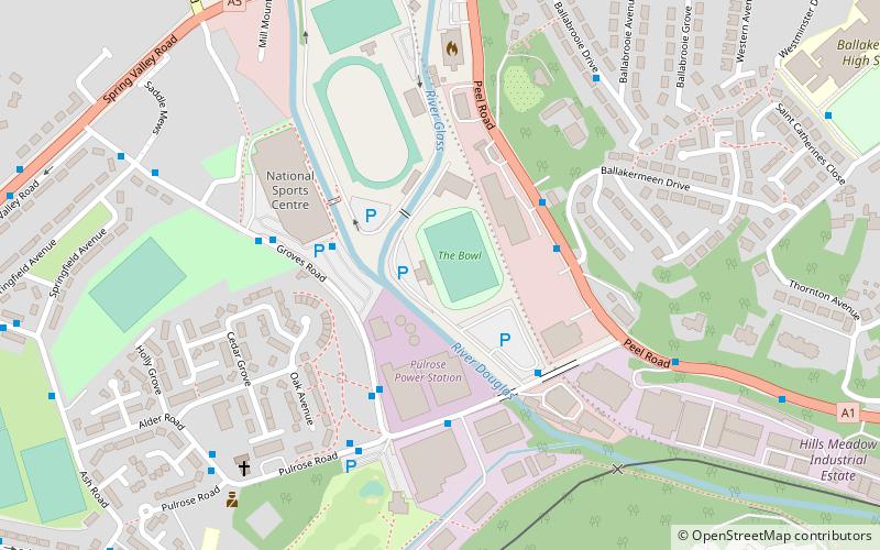
The Bowl ist ein Mehrzweckstadion in Douglas, Isle of Man. Es wird meistens als Fußballstadion verwendet und ist das Heimstadion der Fußballauswahl der Isle of Man sowie des Douglaser Vereins St Marys A.F.C., der derzeit in der höchsten Spielklasse der Insel spielt. Das Stadion fasst etwa 3.000 Zuschauer. ()
Adresse
Douglas
KontaktHinzufügen
Soziale Medien
Hinzufügen
Zugang mit öffentlichen Verkehrsmitteln
Haltestellen der öffentlichen Verkehrsmittel in der Nähe des Standorts
- Busse
- Straßenbahnen
- Bahn
 Busse
Busse
- Bestimmen Sie die RouteNational Sports Centre Layby 4 Min. Fußweg
- Bestimmen Sie die RouteGroves Road / National Sports Centre 4 Min. Fußweg
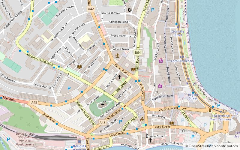
- Bestimmen Sie die RouteVictoria Street 25 Min. Fußweg
- Bestimmen Sie die RouteLoch Promenade 25 Min. Fußweg
- Bestimmen Sie die RouteDouglas Railway Station 19 Min. Fußweg
- Bestimmen Sie die RouteGranville Street 25 Min. Fußweg
- Bestimmen Sie die RouteLoch Promanade / Howard Street 25 Min. Fußweg
- Bestimmen Sie die RouteThe Sefton Hotel 25 Min. Fußweg
Tagesausflüge


Häufig gestellte Fragen (FAQ)
Welche beliebten Attraktionen gibt es in der Nähe?
Zu den nahe gelegenen Attraktionen gehören. Priory of Douglas, Douglas (10 Min. Fußweg), All Saints Church, Douglas (15 Min. Fußweg), Mobile Family Library, Douglas (17 Min. Fußweg), St. Mary of the Isle Church, Douglas (20 Min. Fußweg).
Wie kommt man mit öffentlichen Verkehrsmitteln dorthin?
Bahnhöfe und Haltestellen in der Umgebung von The Bowl:
Busse
Bahn
Straßenbahnen
Busse
- National Sports Centre Layby • Linien: 1 (4 Min. Fußweg)
- Groves Road / National Sports Centre • Linien: 1 (4 Min. Fußweg)
Bahn
- Douglas Railway Station (19 Min. Fußweg)
Straßenbahnen
- Granville Street • Linien: Douglas Horse Tramway (25 Min. Fußweg)
- Loch Promanade / Howard Street • Linien: Douglas Horse Tramway (25 Min. Fußweg)