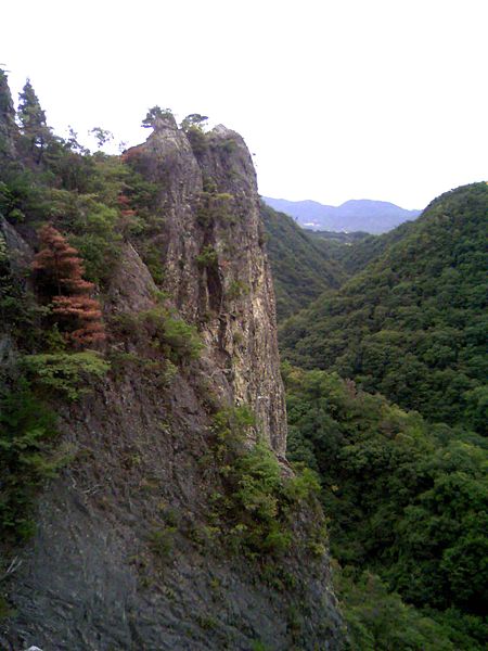
Kamakura Valley, Sanda

Galerie (4)
Karte

Karte
Galerie
Fakten und Informationen
Das Kamakurakyo ist ein geografisches Gebiet in den Rokko-Bergen, Hyōgo, Japan. Dieses Tal ist ein Teil des Setonaikai-Nationalparks in Japan.
Höhenlage: 959 ftKoordinaten: 34°51'17"N, 135°15'22"E
Adresse
北区 (道場町)Sanda
KontaktHinzufügen
Soziale Medien
Hinzufügen
Tagesausflüge