Ferias, Bogotá
Karte
Fakten und Informationen
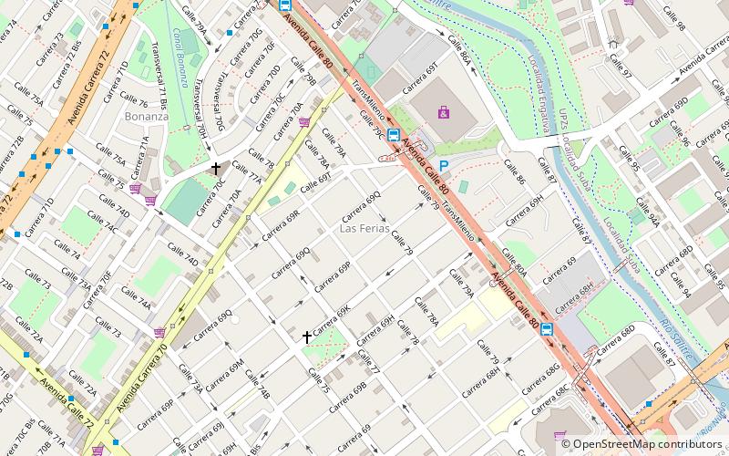
Die einfache Station Ferias ist Teil des TransMilenio-Massentransitsystems von Bogotá, Kolumbien, das im Jahr 2000 eröffnet wurde.
Adresse
Engativá (Las Ferias)Bogotá
KontaktHinzufügen
Soziale Medien
Hinzufügen
Zugang mit öffentlichen Verkehrsmitteln
Haltestellen der öffentlichen Verkehrsmittel in der Nähe des Standorts
- Busse
 Busse
Busse
- Bestimmen Sie die RouteFerias 5 Min. Fußweg
- Bestimmen Sie die RouteBoyacá 10 Min. Fußweg
- Bestimmen Sie die RouteLas Ferias 16 Min. Fußweg
Tagesausflüge


Häufig gestellte Fragen (FAQ)
Welche beliebten Attraktionen gibt es in der Nähe?
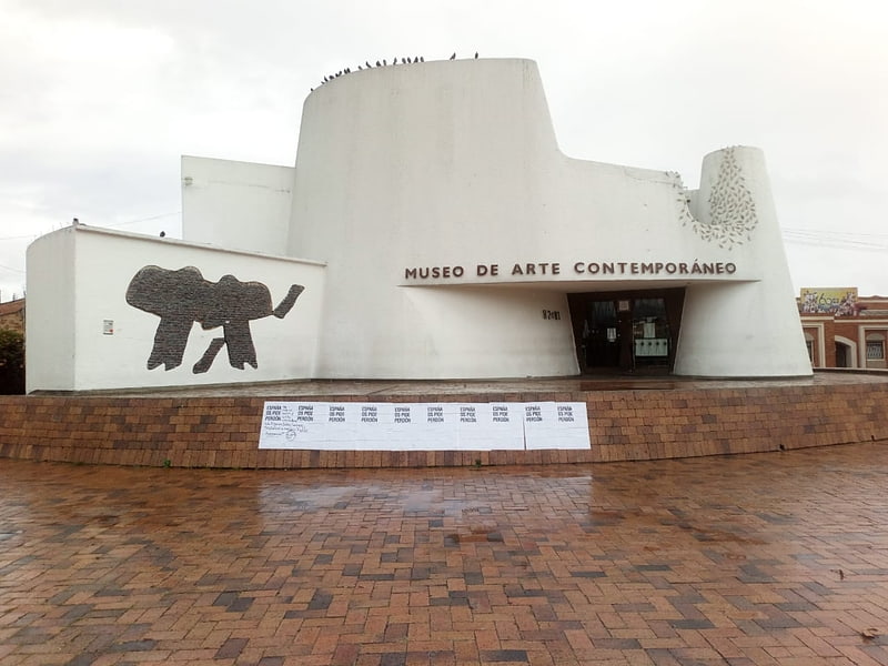
Zu den nahe gelegenen Attraktionen gehören. Avenida 68, Bogotá (14 Min. Fußweg), Santa María del Lago, Bogotá (18 Min. Fußweg), Museum of Contemporary Art of Bogotá, Bogotá (20 Min. Fußweg), Barrios Unidos, Bogotá (22 Min. Fußweg).
Wie kommt man mit öffentlichen Verkehrsmitteln dorthin?
Bahnhöfe und Haltestellen in der Umgebung von Ferias:
Busse
Busse
- Ferias (5 Min. Fußweg)
- Boyacá (10 Min. Fußweg)