St. Philip Howard Church
Fakten und Informationen
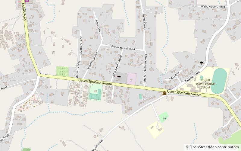
Die Kirche Saint Philip Howard ist eine Gemeinde der römisch-katholischen Kirche in Kingston, Norfolk Island, in der Erzdiözese Sydney. Die Pfarrkirche befindet sich an der Queen Elizabeth Avenue und der John Adams Road.
Die katholische Geschichte der Insel geht auf das Jahr 1800-1 zurück, als die irischen Sträflingspriester Pater James Harold und Pater Peter O'Neil von Sydney dorthin geschickt wurden; Pater O'Neil leitete eine Schule. Der Benediktinerpater Pater William Ullathorne besuchte die Insel bei zwei verschiedenen Gelegenheiten und veröffentlichte 1838 die Broschüre "The Catholic Mission in Australasia", in der er die schlechten Bedingungen und die ungerechte Behandlung der transportierten Sträflinge anprangerte. Die Pfarrei wurde 1959 gegründet und hatte viele Jahre lang einen ansässigen Maristenpriester, der sich um die seelsorgerischen Bedürfnisse der Gemeinde kümmerte. Seit dem Weggang des letzten Maristen im Jahr 1987 schickt die Erzdiözese Gastgeistliche für ein- oder zweiwöchige Aufenthalte auf die Insel, um Messen zu feiern, Taufen durchzuführen und ähnliche Aufgaben zu übernehmen.
Die Kirche wurde anlässlich eines Besuchs von James Kardinal Freeman dem heiligen Philip Howard neu geweiht. Howard war ein englischer Adliger, der 1970 von Papst Paul VI. als einer der Vierzig Märtyrer von England und Wales heiliggesprochen wurde.