City Park, Benicia
Karte
Fakten und Informationen
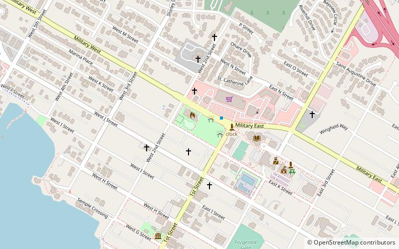
Im City Park in Benicia, Kalifornien, befindet sich ein Busbahnhof, der von SolTrans und Thruway Motorcoach angefahren wird. Hier steht die erste protestantische Kirche in Kalifornien: eine presbyterianische Kirche, die zwischen 1849 und 1875 errichtet wurde. Hier befand sich auch ein Priesterseminar.
Höhe: 56 ft ü. d. M.Koordinaten: 38°3'14"N, 122°9'25"W
Adresse
Military EBenicia (West Side)Benicia 94510
KontaktHinzufügen
Soziale Medien
Hinzufügen
Tagesausflüge
City Park – beliebt in der gegend (entfernung vom objekt)
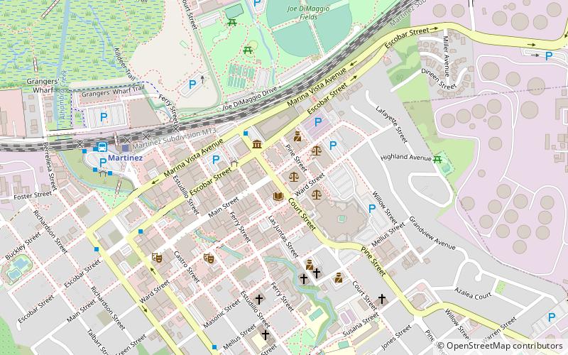
In der Nähe befinden sich unter anderem Attraktionen wie: Benicia State Recreation Area, John Muir National Historic Site, Benicia–Martinez Bridge, Benicia Capitol State Historic Park.


Häufig gestellte Fragen (FAQ)
Welche beliebten Attraktionen gibt es in der Nähe?
Zu den nahe gelegenen Attraktionen gehören. Old Masonic Hall, Benicia (3 Min. Fußweg), Benicia Capitol State Historic Park, Benicia (8 Min. Fußweg).