Trek Zone

Horseshoe Bay Trail, Saint Helena Island National Scenic Area

Nr. 2 unter den Attraktionen in Saint Helena Island National Scenic Area

Wandern, Wanderweg
Horseshoe Bay Trail location map
Karte

Fakten und Informationen

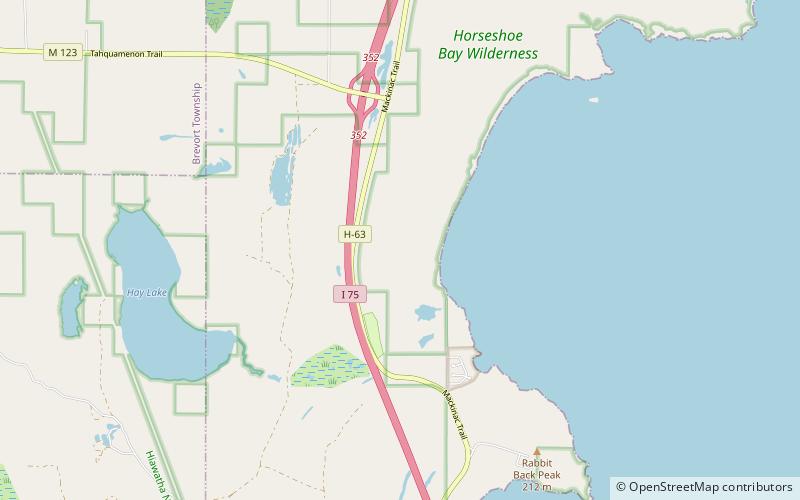
Der Horseshoe Bay Trail ist ein 6,4 Meilen langer Wanderweg, der in die Horseshoe Bay Wilderness führt und dort Schleifen zieht. Das Auto Trailhead, befindet sich direkt außerhalb der Wildnis, ist 6 Meilen nördlich von St. Ignace, MI.

Länge: 6.4 miKoordinaten: 45°56'45"N, 84°44'45"W
Adresse

Saint Helena Island National Scenic Area Vereinigte Staaten

KontaktHinzufügen
Soziale Medien
Hinzufügen
Tagesausflüge

Horseshoe Bay Trail – beliebt in der gegend (entfernung vom objekt)

In der Nähe befinden sich unter anderem Attraktionen wie: Wawashkamo Golf Club, St. Ignace Mission, Wawatam Lighthouse, The Museum of Ojibwa Culture.

  • wawashkamo golf club mackinac island location map
    7.5 miSE
  • st ignace mission5.2 miS
  • wawatam lighthouse st ignace5.7 miS
  • the museum of ojibwa culture st ignace5.2 miS
  • castle rock st ignace2.4 miS
  • fort de buade museum st ignace5.4 miS
  • mackinac trail carp river bridge saint helena island national scenic area5.2 miN
  • lasanen site st ignace location map
    5.5 miS
  • marquette street archaeological district st ignace5.5 miS
  • horseshoe bay wilderness saint helena island national scenic area location map
    2.4 miNE
  • british landing mackinac island6.8 miSE

Wohin als nächstes? Gehen Sie auf die Seite der Region michigan Michigan oder sehen Sie sich alle Orte und Sehenswürdigkeiten in den Vereinigten Staaten an.