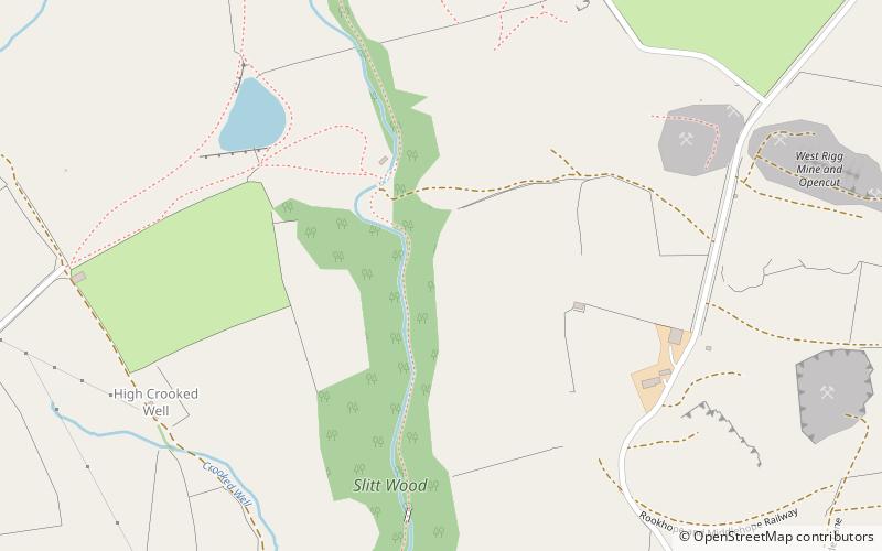
Slit Woods
Fakten und Informationen
Slitt Woods ist ein Gebiet von besonderem wissenschaftlichen Interesse im Bezirk Wear Valley in der Grafschaft Durham, England. Es liegt im Tal des Middlehope Burn, eines Nebenflusses des Wear, in den er bei Westgate, unmittelbar südlich des Gebiets, mündet.
Das Gebiet weist eine Vielzahl von Lebensräumen auf, darunter Wälder, kalkhaltiges Grasland, Moore und begrünte Grubenbaue.
Der Wald ist geprägt von Esche und Bergulme mit Hasel als Unterwuchs. Zu den Bodendeckern gehören die Große Glockenblume, die Kugelblume, der Waldstorchschnabel und der Sumpfbocksbart.
Das Gebiet umfasst die stillgelegten Abbaustätten zweier ehemaliger Bleibergwerke, Slitt Mine und Middlehope Mine. Auf den Abfällen dieser Minen wächst offenes Grasland, in dem sich der Metallophyt Frühlings-Sandkraut, Minuartia verna, angesiedelt hat.