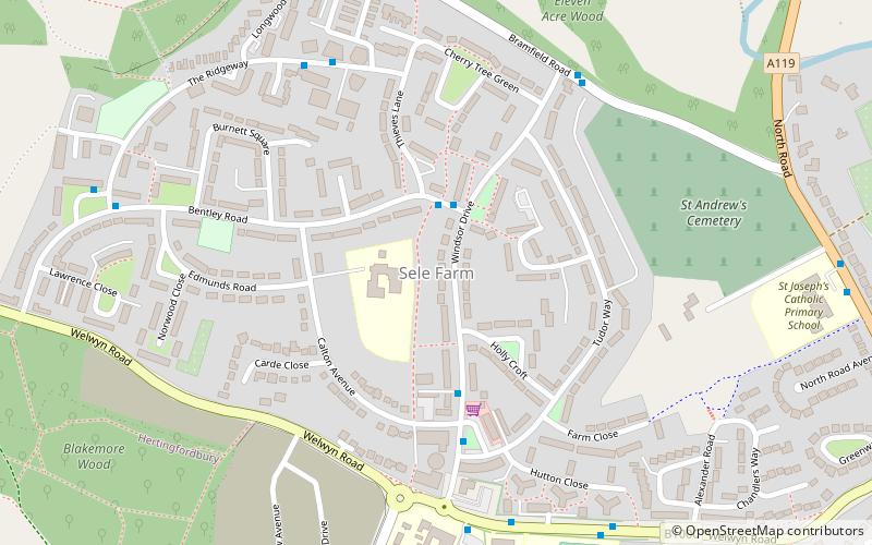
Sele Farm, Hertford
Karte
Fakten und Informationen
Sele Farm ist ein Gebiet am nordwestlichen Rand von Hertford, Hertfordshire.
Koordinaten: 51°48'7"N, 0°6'8"W
Adresse
Hertford
KontaktHinzufügen
Soziale Medien
Hinzufügen
Zugang mit öffentlichen Verkehrsmitteln
Haltestellen der öffentlichen Verkehrsmittel in der Nähe des Standorts
- Busse
- Bahn
 Busse
Busse
- Bestimmen Sie die RouteFordwich Rise 7 Min. Fußweg
- Bestimmen Sie die RouteHertford North Railway Station 13 Min. Fußweg
- Bestimmen Sie die RouteCounty Hospital 18 Min. Fußweg
- Bestimmen Sie die RouteHertford North 13 Min. Fußweg
Tagesausflüge


Häufig gestellte Fragen (FAQ)
Wie kommt man mit öffentlichen Verkehrsmitteln dorthin?
Bahnhöfe und Haltestellen in der Umgebung von Sele Farm:
Busse
Bahn
Busse
- Fordwich Rise • Linien: 724 (7 Min. Fußweg)
- Hertford North Railway Station • Linien: 724 (13 Min. Fußweg)
Bahn
- Hertford North (13 Min. Fußweg)