Top Valley, Nottingham

Datos e información práctica
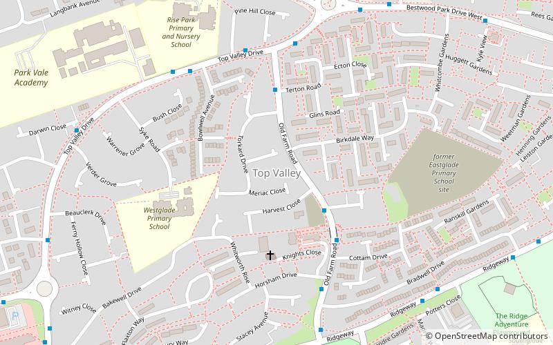
Top Valley es una zona mayoritariamente residencial en el noroeste de Nottingham, Inglaterra. Se encuentra al sur de Rise Park, al norte y al oeste de Bestwood, al suroeste de Bestwood Village y al este de Bulwell. Está a unos 6 kilómetros del centro de Nottingham.
La urbanización se construyó en la década de 1970 en los terrenos de las granjas Top Valley, Forest y Home. En su mayor parte, la construcción avanzó de oeste a este y las primeras casas aparecieron antes de finales de 1972. La granja Top Valley se derribó en 1973 y se sustituyó por Knights Close, mientras que la granja Forest se encontraba en la esquina suroeste de lo que ahora es Brisbane Drive.
A finales de 1982 se abrió un supermercado Tesco en el antiguo emplazamiento de las obras de los vagones de ferrocarril al sur de Top Valley Way, ya que la propia línea de ferrocarril se cerró a mediados de la década de 1960 y ahora es un sendero arbolado en el límite occidental de la urbanización. El edificio original del supermercado fue demolido y sustituido por una construcción más grande hacia 2005/06.
Otro cambio notable se produjo durante la década de 2010 en la zona de Bakewell Drive, con la demolición de varias viviendas y su sustitución por otras modernas. A principios de 2018 se demolió el antiguo hogar infantil de Ranskill Gardens. Positive Homes está construyendo ocho nuevas "ecohomes" en el emplazamiento, todas ellas con una calificación "A" en el Certificado de Rendimiento Energético, lo que las convierte en unas de las viviendas más eficientes del Reino Unido. En 2019 se construirá un gran proyecto de viviendas ecológicas en la antigua escuela primaria de Eastglade, a cargo de Nottingham City Homes.
Bulwell ForestNottingham
Top Valley – popular en la zona (distancia de esta atracción)
En las cercanías se encuentran, entre otras, atracciones como: Leen Valley, Church of St Mary the Virgin and All Souls, Bestwood Park, Highbury Vale.
Preguntas frecuentes (FAQs)
¿Qué atracciones populares hay cerca?
¿Cómo llegar en transporte público?
Autobuses
- Knights Close • Líneas: 79, 88, S20 (3 min. a pie)
- Muirfield Road • Líneas: 89 (7 min. a pie)
Tranvías
- Bulwell Forest • Líneas: 1 (23 min. a pie)
- Moor Bridge • Líneas: 1 (24 min. a pie)
Ferrocarril
- Bulwell (31 min. a pie)


