Charity Creek, Sydney
Carte
Faits et informations pratiques
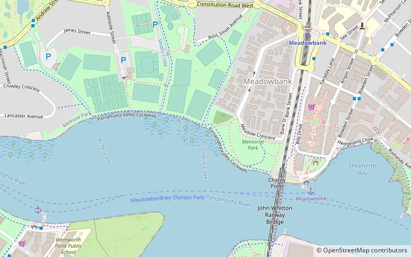
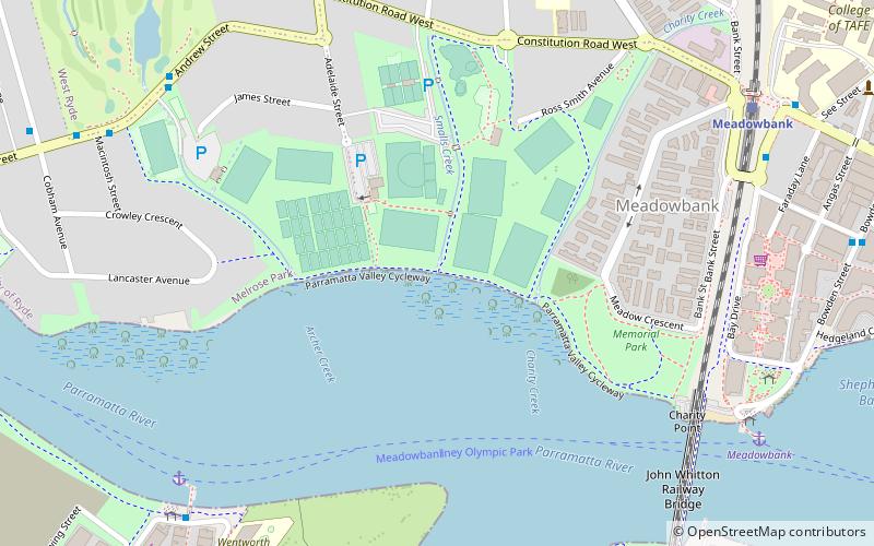
Charity Creek, un affluent nord de la rivière Parramatta, est un ruisseau à l'ouest du port de Sydney, situé à Sydney, en Nouvelle-Galles du Sud, en Australie. Il rejoint la rivière Parramatta à Meadowbank Park, Meadowbank.
Coordonnées: 33°49'9"S, 151°5'9"E
Adresse
MeadowbankSydney
ContactAjouter
Médias sociaux
Ajouter
Accès par les transports publics
Arrêts de transport public à proximité du site
- Autobus
- Chemin de fer
- Ferry
 Autobus
- Déterminer l'itinéraireMeadowbank Wharf, Bowden St 7 min. de marche
- Déterminer l'itinéraireMeadowbank Station, Constitution Rd 10 min. de marche
- Déterminer l'itinéraireMeredith Ave 10 min. de marche
- Déterminer l'itinéraireAdelaide St At Hibble St 12 min. de marche
- Déterminer l'itinéraireMeadowbank 8 min. de marche
- Déterminer l'itinéraireSydney Olympic Park 12 min. de marche
- Déterminer l'itinéraireKissing Point 33 min. de marche
- Déterminer l'itinéraireMeadowbank 9 min. de marche
- Déterminer l'itinéraireRhodes 20 min. de marche
- Déterminer l'itinéraireWest Ryde 23 min. de marche
Cartes Trains de SydneyCartes
 Métro léger de SydneyCartes
 Ferries
Trains de SydneyCartesMétro léger de SydneyCartesFerriesExcursions d'une journée


Foire aux questions (FAQ)
Quelles sont les attractions populaires à proximité ?
Les attractions à proximité comprennent Smalls Creek, Sydney (3 min. de marche), John Whitton Bridge, Sydney (7 min. de marche), Archer Creek, Sydney (8 min. de marche), Ryde Bridge, Sydney (16 min. de marche).
Comment s'y rendre par les transports publics ?
Stations et arrêts à proximité de Charity Creek :
Autobus
Ferry
Chemin de fer
Autobus
- Meadowbank Wharf, Bowden St • Lignes: 518 (7 min. de marche)
- Meadowbank Station, Constitution Rd • Lignes: 507, 518 (10 min. de marche)
Ferry
- Meadowbank • Lignes: F3 (8 min. de marche)
- Sydney Olympic Park • Lignes: F3 (12 min. de marche)
Chemin de fer
- Meadowbank (9 min. de marche)
- Rhodes (20 min. de marche)