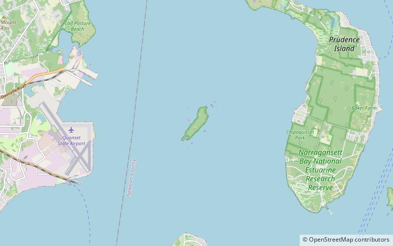
Narragansett Bay National Estuarine Research Reserve, Hope Island
Faits et informations pratiques
La réserve de recherche nationale de la baie de Narragansett est une zone marine protégée des États-Unis située sur la prudence, la patience et les îles Hope dans la baie de Narragansett dans l'État de Rhode Island.
Il a été créé en août 1980 en vertu de la Loi sur la gestion des zones côtières. La réserve englobe 2 353 acres de terrain ainsi que 1 591 acres d'eau adjacente aux îles à une profondeur de 18 pieds. Pendant l'ère coloniale, les trois îles ont été utilisées pour l'agriculture. Au 20e siècle, l'agriculture avait diminué et l'île Prudence a commencé à attirer des résidents d'été. Pendant la Seconde Guerre mondiale, l'armée américaine a établi une présence sur l'île et est restée jusqu'en 1972, lorsque le terrain a été remis à l'État du Rhode Island.
Il englobe les habitats côtiers, estuariens et de marée.
La réserve est gérée par le Rhode Island Department of Environmental Management en tant que partenariat fédéral / étatique en coopération avec la NOAA.
Hope Island
Narragansett Bay National Estuarine Research Reserve – populaire dans la région (distance de cette attraction)
À proximité, vous trouverez notamment des attractions telles que : Old Narragansett Church, Green Animals Topiary Garden, Seabee Museum, Smith's Castle.