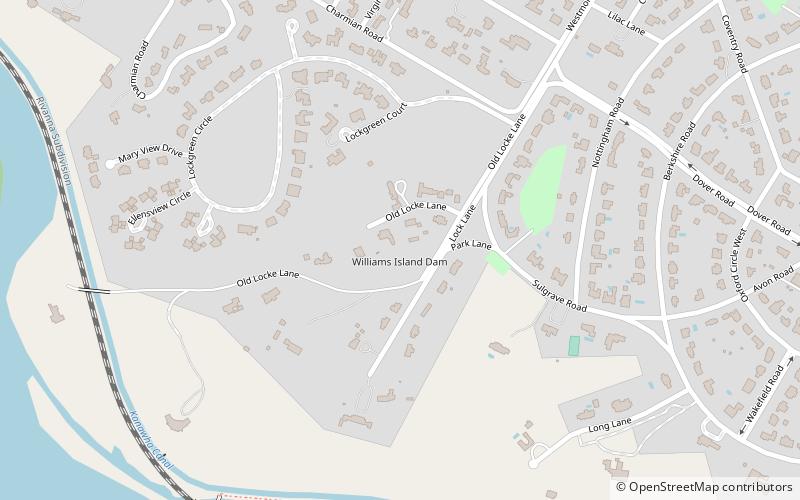
Williams Island Dam, Richmond
Faits et informations pratiques
Le barrage de l'île de Williams est situé sur la rivière James dans la ville indépendante de Richmond, en Virginie. Juste en dessous du barrage, sept miles de rapides marquent la descente de la rivière en aval à travers la région de la ligne d'automne géologique jusqu'à la partie marée navigable en dessous de Richmond, qui s'étend au sud-est jusqu'à Hampton Roads.
Le barrage de l'île de Williams a été construit en 1905 dans le cadre d'un projet en eau potable de la ville de Richmond qui a utilisé une partie de l'ancien canal de James et de Kanawha le long de la rive nord de la rivière à l'ouest de Richmond. Un barrage de gravité, sa hauteur est de 7 pieds. Sa capacité de stockage normale est estimée à 50 acres-pieds. Il était lié à un bâtiment des premiers waterworks qui est situé sur Pumphouse Drive juste à l'ouest du pont de boulevard de la ville.
Le barrage de l'île de Williams est entièrement situé dans le système James River Park de la ville. L'île Williams, qui sépare les deux sections du barrage, est une réserve faunique de 95 acres et a le nid d'un pygargue à tête blanche. Selon le site Web de James River Park, Richmond est la seule capitale des 48 États inférieurs à avoir un aigle nichant à l'intérieur des limites de l'entreprise.
Near West End (Wilton)Richmond
- Autobus
 Autobus
- Déterminer l'itinérairePatterson + Malvern 33 min. de marche
Williams Island Dam – populaire dans la région (distance de cette attraction)
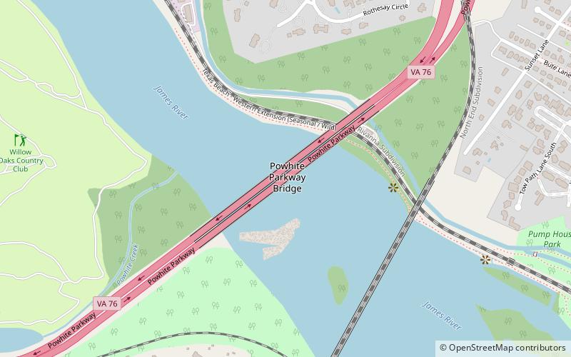
À proximité, vous trouverez notamment des attractions telles que : Agecroft Hall, Virginia House, Wilton House Museum, Powhite Parkway Bridge.


Foire aux questions (FAQ)
Quelles sont les attractions populaires à proximité ?
Comment s'y rendre par les transports publics ?
Autobus
- Patterson + Malvern • Lignes: 76 (33 min. de marche)