Timeline of the BeltLine, Atlanta

Faits et informations pratiques
C'est la chronologie du développement de la Beltline, un anneau de sentiers et de parcs autour d'Atlanta.
1999 Ryan Gravel's master's thesis, 2003 Georgia Tech senior design project is first feasibility study done on the beltline and presented to the Atlanta City Council. The study included the first public support analysis which showed overwhelming public support for the project. 2004 Trust for Public Land publishes Alexander Garvin's Emerald Necklace proposal, 2005July — Atlanta BeltLine Partnership formed, November 7 — city council approves Tax-allocation district and Redevelopment Area, December 12 — Atlanta school board unanimously approves TAD. However, in 2006 the state Supreme Court later rules that schools' participation in a TAD is unconstitutional. December 21 — Fulton County Commission approves TAD, 2006April 19 — Fulton County Commission approves sale of Bellwood Quarry for Westside Park. July — Atlanta BeltLine, Inc. was formed by Invest Atlanta and the Five Year Work Plan was adopted by City Council. September 21 — developer Wayne Mason who owns the 5-mile northeast segment withdraws his rezoning applications from the city. Mason, a suburban land speculator, had purchased the railroad right of way from Norfolk Southern in 2004. Rather than preserving the property as a greenway and transit corridor, Mason proposed a deal with the city whereby he would give a portion of his land in exchange for the right to develop the remainder to extremely high densities. The most controversial component of his plan was a proposal to build 38- and 39-story condominiums on the eastern edge of Piedmont Park, in an area dominated by historic single family homes. Mason's proposal galvanized the adjacent neighborhoods to organize, forming the Beltline Neighbors Coalition. Despite paid lobbying on Mason's behalf by such heavyweights as former Governor Roy Barnes, in the end the city held firm with the original intention of preserving the corridor as transit and greenspace. December 11 — After soliciting comments from the public, MARTA recommends rail service for the corridor, even though bus rapid transit technology would have possible lower capital costs. 2007January — The Atlanta BeltLine Affordable Housing Advisory Board was established. February — The BeltLine overlay district is approved, rezoning the area to steer development near the BeltLine. March — The Atlanta BeltLine Tax Allocation District Advisory Committee was established. March — Master planning and community engagement commenced, consistent with the Citizen Participation Framework adopted by City Council. June 13 — city of Atlanta purchases over 21 acres near Grant Park for part of the "jewel" called Boulevard Crossing in the Emerald Necklace study. August 7 — Atlanta Beltline Inc acquires the first section of the corridor. In partnership with Ben Raney and Barry Real Estate Companies, ABI announces the purchases of the NE section of the Atlanta BeltLine from developers Wayne and Keith Mason. November 12 — $8 million allocated to purchase land where North Avenue crosses the Beltline for a 16-acre park. 2008February 23 — 150 people attended a community groundbreaking for the West End trail at Rose Circle Park. Summer — MARTA and the Federal Transit Administration, in partnership with ABI, commenced the Tier 1 Environmental Impact Statement, to make the project competitive for future federal transit funding. October 15 — Groundbreaking takes place for the Historic Fourth Ward Park on North Avenue, the first part of the BeltLine. October — West End Trail Phase I, built by the PATH Foundation, opened in southwest Atlanta — enhanced by Trees Atlanta's Atlanta BeltLine arboretum. Atlanta BeltLine renovated Gordon White Park. October — Atlanta BeltLine Affordable Housing Trust Fund policies adopted by City Council. First Atlanta BeltLine TAD Bonds issued, totaling $64.5 million. The Atlanta BeltLine Affordable Housing Trust Fund was capitalized with $8.8 million in TAD Bond proceeds. November — A statewide referendum allows school districts to opt into a TAD, allowing APS to participate in the BeltLine TAD. 2009June — With the Atlanta BeltLine TAD Advisory Committee, ABI developed and adopted an equitable development plan. July — ABI entered an option agreement and a lease with GDOT for 3.5 miles of the Atlanta BeltLine corridor in the southwest and Reynoldstown. December — Groundbreaking on the first trail occurs, where mayor-elect Kasim Reed announces he wants to make the BeltLine a reality in 10 years, instead of 25. 2010April — Opening ceremony for a 1-mile segment of trail that snakes through Tanyard Creek Park, Louise G. Howard Park, and along Bobby Jones Golf...
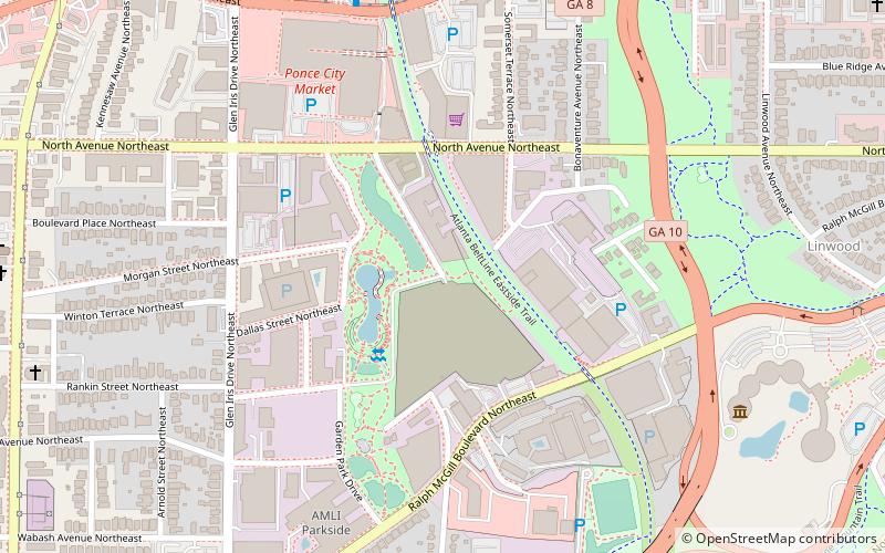
Northeast Atlanta (Old Fourth Ward)Atlanta
- Métro
- Trams
 Métro
Métro
- Déterminer l'itinéraireInman Park/Reynoldstown 26 min. de marche
- Déterminer l'itinéraireKing Historic District 29 min. de marche
- Déterminer l'itinéraireEdgewood at Hillard 32 min. de marche
- Déterminer l'itinéraireDobbs Plaza 33 min. de marche
- Déterminer l'itinéraireSweet Auburn Market 36 min. de marche
Timeline of the BeltLine – populaire dans la région (distance de cette attraction)
À proximité, vous trouverez notamment des attractions telles que : Clermont Lounge, Virginia–Highland, Jimmy Carter Library and Museum, Variety Playhouse.


Foire aux questions (FAQ)
Quelles sont les attractions populaires à proximité ?
Comment s'y rendre par les transports publics ?
Métro
- Inman Park/Reynoldstown • Lignes: Blue, Green (26 min. de marche)
Trams
- King Historic District • Lignes: Atlanta Streetcar (29 min. de marche)
- Edgewood at Hillard • Lignes: Atlanta Streetcar (32 min. de marche)