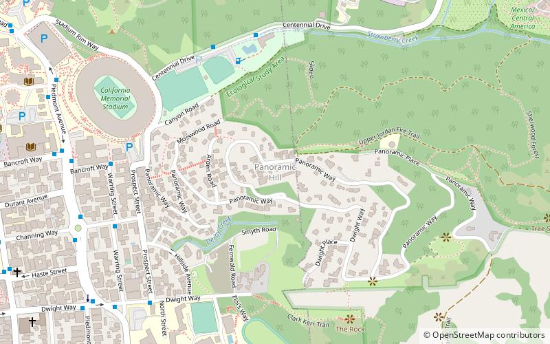
Panoramic Hill, Berkeley
Carte
Faits et informations pratiques
Panoramic Hill est un quartier résidentiel des villes de Berkeley et d'Oakland, en Californie, définies par les maisons le long et dans le couloir d'accès défini par Panoramic Way.
Coordonnées: 37°52'9"N, 122°14'45"W
Adresse
Berkeley (Panoramic Hill)Berkeley
ContactAjouter
Médias sociaux
Ajouter
Accès par les transports publics
Arrêts de transport public à proximité du site
- Autobus
 Autobus
- Déterminer l'itinéraireStrawberry Canyon Recreational Area 6 min. de marche
- Déterminer l'itinéraireWarring Street & Bancroft Way 8 min. de marche
- Déterminer l'itinérairePiedmont Avenue & Channing Way 9 min. de marche
Excursions d'une journée
Panoramic Hill – populaire dans la région (distance de cette attraction)
À proximité, vous trouverez notamment des attractions telles que : Telegraph Avenue, Lawrence Hall of Science, Sather Tower, California Memorial Stadium.


Foire aux questions (FAQ)
Quelles sont les attractions populaires à proximité ?
Les attractions à proximité comprennent California Memorial Stadium, Berkeley (8 min. de marche), Thorsen House, Berkeley (9 min. de marche), Piedmont Avenue, Berkeley (9 min. de marche), Tightwad Hill, Berkeley (10 min. de marche).
Comment s'y rendre par les transports publics ?
Stations et arrêts à proximité de Panoramic Hill :
Autobus
Autobus
- Strawberry Canyon Recreational Area • Lignes: H (6 min. de marche)
- Warring Street & Bancroft Way • Lignes: Ss (8 min. de marche)