Rainbow Honor Walk, San Francisco
Faits et informations pratiques
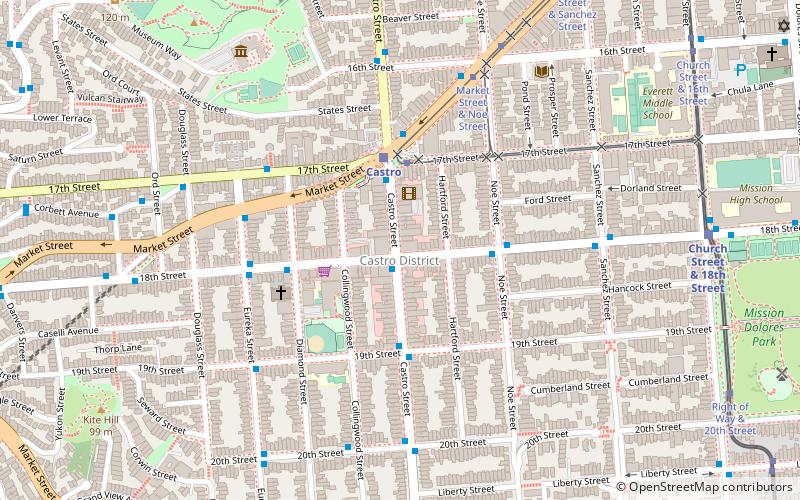
The Rainbow Honor Walk est une installation de renommée de la renommée à San Francisco, en Californie, pour honorer des individus notables, gays, bisexuels, transgenres et queer du monde entier "qui ont laissé une marque durable sur la société". Ses plaques de bronze honorent les personnes LGBTQ qui "ont apporté des contributions importantes dans leurs domaines". Les plaques marquent une promenade située dans le quartier des affaires du quartier de Castro, qui depuis des décennies est le centre de l'activisme et de la culture LGBTQ de la ville.
Le projet a été fondé par David Perry pour honorer les pionniers LGBTQ, qui sont considérés comme ayant jeté les bases des droits LGBTQ, et pour enseigner les générations futures à leur sujet. Les installations de trottoir sont prévues pour s'étendre à la Harvey Milk Civil Rights Academy de la 19th Street & Collingwood, pour continuer le long de Castro Street jusqu'à son intersection avec Market Street et suivre le marché du San Francisco LGBTQ Community Center à Octavia Boulevard; De plus, la marche se ramifiera dans les deux sens à la 18e rue et à Castro. Le RHW pourrait finalement compter jusqu'à 500 lauréats. Le premier tour de vingt plaques a été installé en 2014, un deuxième tour de vingt-quatre a été achevé en 2019.
Une installation séparée de trottoir, la Walk History Walk de Castro Street, est une série de vingt plaques de fait historiques sur le quartier - dix avant 1776 aux années 1960 avant que le Castro ne devienne un quartier gay, et dix "événements significatifs associés au queer Communauté du Castro "- liée dans les 400 et 500 blocs de la rue entre les 19e et les rues du marché.
Southwest San Francisco (Castro)San Francisco
- Métro
- Autobus
- Trolleybus
- Trams
- Métro léger
- Chemin de fer
 Métro
Métro
- Déterminer l'itinéraire18th Street & Castro Street 1 min. de marche
- Déterminer l'itinéraireCastro Street & 18th Street 1 min. de marche
- Déterminer l'itinéraire17th Street & Castro Street 3 min. de marche
- Déterminer l'itinéraireMarket Street & Church Street 15 min. de marche
- Déterminer l'itinéraireMarket Street & Castro Street 3 min. de marche
- Déterminer l'itinéraire17th Street & Diamond Street 5 min. de marche
- Déterminer l'itinéraireMarket Street & 16th Street 6 min. de marche
- Déterminer l'itinéraireCorbett Avenue & Douglass Street 7 min. de marche
- Déterminer l'itinéraireCastro 4 min. de marche
- Déterminer l'itinéraireChurch Street & 18th Street 10 min. de marche
- Déterminer l'itinéraireRight of Way & 18th Street 10 min. de marche
- Déterminer l'itinéraire16th Street Mission 23 min. de marche
- Déterminer l'itinéraire24th Street Mission 28 min. de marche
- Déterminer l'itinéraireCarl Street & Cole Street 23 min. de marche
 Muni Metro
Rainbow Honor Walk – populaire dans la région (distance de cette attraction)
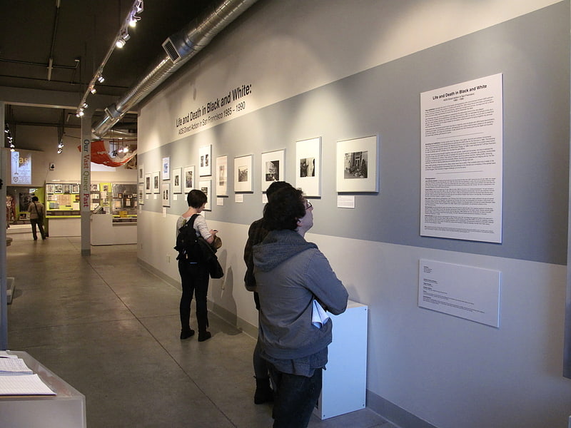
À proximité, vous trouverez notamment des attractions telles que : GLBT History Museum, Dolores Park, Wiggle Bicycles, Mission Saint-François-d'Assise.


Foire aux questions (FAQ)
Quelles sont les attractions populaires à proximité ?
Comment s'y rendre par les transports publics ?
Trolleybus
- 18th Street & Castro Street • Lignes: 33 (1 min. de marche)
- Castro Street & 18th Street • Lignes: 24 (1 min. de marche)
Trams
- 17th Street & Castro Street • Lignes: F (3 min. de marche)
- Market Street & Church Street • Lignes: F (15 min. de marche)
Autobus
- Market Street & Castro Street • Lignes: 37, Kbus, L-Owl, Lbus (3 min. de marche)
- 17th Street & Diamond Street • Lignes: 37 (5 min. de marche)
Métro léger
- Castro • Lignes: K, S, T (4 min. de marche)
- Church Street & 18th Street • Lignes: J (10 min. de marche)
Métro
- 16th Street Mission • Lignes: Blue, Green, Red, Yellow (23 min. de marche)
- 24th Street Mission • Lignes: Blue, Green, Red, Yellow (28 min. de marche)
Chemin de fer
- Carl Street & Cole Street (23 min. de marche)