Redwood Heights, Oakland


Faits et informations pratiques
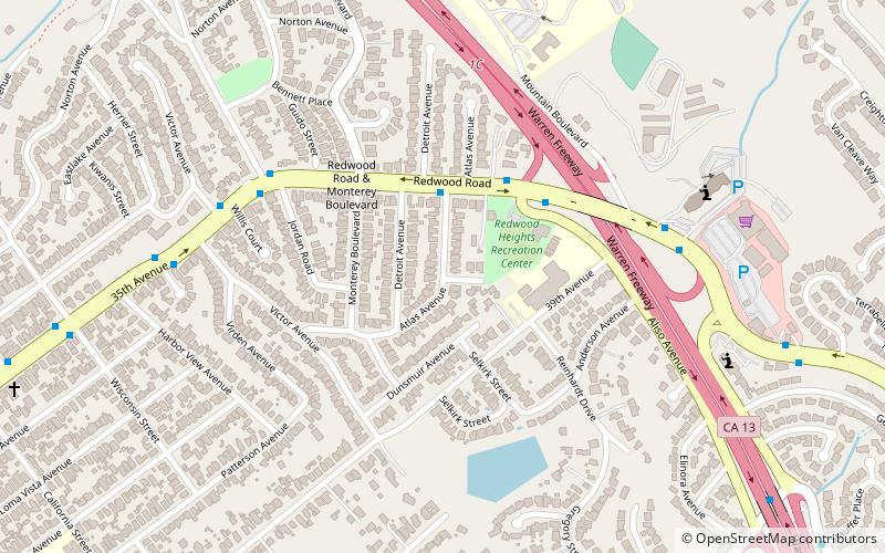
Redwood Heights est un quartier résidentiel principalement de la classe moyenne et très diversifié dans les collines d'East Oakland, en Californie. Il est centré sur Redwood Road, qui était autrefois une route forestière. Actuellement, Redwood Road est la désignation de la 35e Avenue à partir d'un mile au nord du boulevard MacArthur entre Victor Avenue et la Warren Freeway. Il comprend l'école primaire Redwood Heights des 2 arbres de séquoias sur les locaux de l'école. L'un a été planté en 1963 en souvenir de John F Kennedy. Et un centre de loisirs qui se double d'une garderie après l'école. Il se trouve à une altitude de 476 pieds.
Les maisons à Redwood Heights datent principalement des années 1920 à 1950 et varient considérablement dans le style, de Craftsman, au «livre de contes» à ranch; Le premier développement de la région était Avenue Terrace. Il y a un grand "obélisque" rocheux au coin de la 35th Ave et Victor qui dit "Avenue Terrace" et pourrait avoir été un marqueur pour le développement. Il y a aussi un parc d'avenue Terrace, qui est situé ailleurs dans le quartier.
Redwood Heights a la distinction importante d'être l'un des quartiers les plus diversifiés d'Oakland avec une population principalement de la classe moyenne. Le recensement de 2010 reflète le principal code postal pour le quartier comme ayant environ 23 200 résidents, les Caucasiens représentant environ 29,9% de la population, les Afro-Américains 26,2%, les Asiatiques 22% et les Latinos 16,1%, avec d'autres races formant les 5,8% restants de 5,8%.
Lower Hills District (Redwood Heights)Oakland
Redwood Heights – populaire dans la région (distance de cette attraction)
À proximité, vous trouverez notamment des attractions telles que : Temple mormon d'Oakland, Joaquin Miller Park, Ascension Greek Orthodox Cathedral of Oakland, Roberts Regional Recreation Area.
Foire aux questions (FAQ)
Quelles sont les attractions populaires à proximité ?
Comment s'y rendre par les transports publics ?
Autobus
- Redwood Road & Atlas Avenue • Lignes: 54 (3 min. de marche)
- 35th Avenue & Jordan Road • Lignes: 54 (6 min. de marche)


