Roosevelt Boulevard, Philadelphie
Faits et informations pratiques
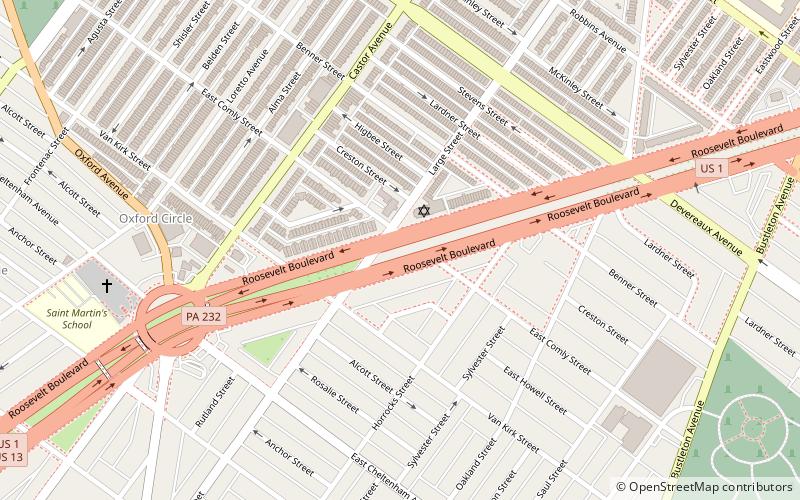
Roosevelt Boulevard, officiellement nommé Boulevard Memorial Theodore Roosevelt et souvent appelé, principalement par les Philadelphiens locaux, simplement comme "le boulevard" ou "The Bouly" est une artère de circulation majeure à travers le nord et le nord-est de Philadelphie. The road begins at the Schuylkill Expressway in Fairmount Park, running as a freeway also known as the Roosevelt Boulevard Extension or the Roosevelt Expressway through North Philadelphia, then transitioning into a twelve-lane divided highway that forms the spine of Northeast Philadelphia to its end at la ligne de la ville.
Historiquement, Roosevelt Boulevard fait partie de la Lincoln Highway, la première route à travers l'Amérique, qui s'est déroulée sur 3 389 miles de Times Square à New York à Lincoln Park sur l'océan Pacifique à San Francisco, en Californie.
Aujourd'hui, Roosevelt Boulevard est désigné comme US 1, US 13 et Pennsylvania Route 63.
La route est connue pour deux intersections qui ont été désignées les deuxième et troisième intersections les plus dangereuses du pays par l'assurance agricole d'État, à Red Lion Road et Grant Avenue respectivement. La réputation dangereuse de la route a conduit à l'installation des premiers caméras à lumière rouge à Philadelphie en 2004. La route a été le théâtre de nombreuses victimes et études piétonnes est en cours pour permettre à la circulation des piétons de se séparer de la circulation des véhicules.
Near Northeast Philadelphia (Oxford Circle)Philadelphie
- Métro
- Autobus
 Métro
Métro
- Déterminer l'itinéraireSEPTA Frankford Transportation Center 17 min. de marche
- Déterminer l'itinéraireFrankford Transportation Center 18 min. de marche
- Déterminer l'itinéraireFrankford Transportation Center 18 min. de marche
- Déterminer l'itinéraireArrott Transportation Center 30 min. de marche
 SEPTA Chemin de fer régional
Roosevelt Boulevard – populaire dans la région (distance de cette attraction)
À proximité, vous trouverez notamment des attractions telles que : Église Saint-Guillaume de Philadelphie, Har Nebo Cemetery, Frankford Branch, Cedar Hill Cemetery.


Foire aux questions (FAQ)
Quelles sont les attractions populaires à proximité ?
Comment s'y rendre par les transports publics ?
Autobus
- SEPTA Frankford Transportation Center (17 min. de marche)
- Frankford Transportation Center (18 min. de marche)
Métro
- Frankford Transportation Center • Lignes: Mfl (18 min. de marche)
- Arrott Transportation Center • Lignes: Mfl (30 min. de marche)