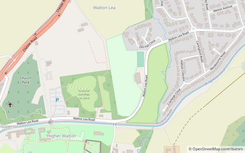
Walton Lea Road, Warrington
Faits et informations pratiques
Walton Lea Road est un terrain de cricket à Warrington. Le premier match enregistré sur le terrain a eu lieu en 1881, lorsque Warrington a joué Huyton.
Le premier match de championnat des comtés mineurs qui s'est tenu sur le terrain est venu en 1978 lorsque le Cheshire a joué le Lancashire Second XI. De 1978 à 1994, le terrain a organisé 9 matchs de championnat des comtés mineurs, avec le dernier match du championnat des comtés mineurs qui s'est tenu sur le terrain en 1994 lorsque le Cheshire a joué Berkshire. De plus, entre 1986 et 1996, le terrain a tenu 5 matchs de trophée à knockout McCA, dont le dernier a vu le Cheshire jouer le Hertfordshire.
Le terrain a également organisé une seule liste de liste entre Cheshire et Nottinghamshire dans le 1er tour du trophée Natwest 1993.
Au cours de la Coupe du monde de cricket féminin en 1993, le terrain a organisé une seule journée pour femmes entre les femmes australiennes et les Pays-Bas.
Dans le cricket domestique local, le sol est le lieu d'origine du Warrington Cricket Club.
Warrington
- Autobus
 Autobus
- Déterminer l'itinéraireWalton Stag Inn 11 min. de marche
- Déterminer l'itinéraireThe Vicarage 14 min. de marche
- Déterminer l'itinéraireCentral Avenue 31 min. de marche


Foire aux questions (FAQ)
Quelles sont les attractions populaires à proximité ?
Comment s'y rendre par les transports publics ?
Autobus
- Walton Stag Inn • Lignes: 62 (11 min. de marche)
- The Vicarage • Lignes: 62 (14 min. de marche)