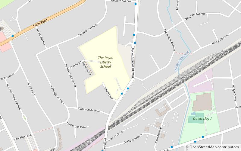
Hare Hall, Romford
Faits et informations pratiques
Hare Hall est une maison et un terrain situé à Gidea Park dans l'arrondissement de London de Havering, East London.
Il a été construit en 1769-1770 en tant que maison de campagne pour John A. Wallinger et depuis 1921, a abrité la Royal Liberty School.
Le manoir palladien a été construit aux conceptions de James Paine, qui l'a inclus dans ses plans publiés. Le front nord principal est de cinq baies, avec un étage de sous-sol rustiqué, au-dessus desquels les deux étages supérieurs sont unifiés par un portique géante et des pilastres aux angles.
Attaché au front sud par des couloirs courts, il y avait des pavillons contenant des salles de service. Les salles principales étaient au premier étage et ont été approchées par un escalier central avec des extrémités incurvées et une balustrade en fer forgé. Le front principal était de Portland Stone, mais le front sud était en brique rouge. En 1896, la maison a été considérablement agrandie de ce côté en remplissant l'espace entre les pavillons. Au goujon entretenu à Hare Park, Cherimoya, poulichée en 1908, a été élevé par l'entrepreneur minier sud-africain et cavalier William Broderick Cloete; Après la mort de Cloete dans le naufrage de la Lusitania, pendant le parc de Hare Hall de la Première Guerre mondiale est devenu Hare Hall Camp et abritait le 2e bataillon des fusils d'artistes.
Havering (Ardleigh Green)Romford
- Autobus
- Chemin de fer
 Autobus
- Déterminer l'itinéraireRoyal Liberty School 2 min. de marche
- Déterminer l'itinéraireBelgrave Avenue 4 min. de marche
- Déterminer l'itinéraireDurham Avenue 7 min. de marche
- Déterminer l'itinéraireWestern Avenue 7 min. de marche
- Déterminer l'itinéraireGidea Park 9 min. de marche
- Déterminer l'itinéraireHarold Wood 30 min. de marche
- Déterminer l'itinéraireEmerson Park 32 min. de marche


Foire aux questions (FAQ)
Quelles sont les attractions populaires à proximité ?
Comment s'y rendre par les transports publics ?
Autobus
- Royal Liberty School • Lignes: 496, 674 (2 min. de marche)
- Belgrave Avenue • Lignes: 496, 674 (4 min. de marche)
Chemin de fer
- Gidea Park (9 min. de marche)
- Harold Wood (30 min. de marche)