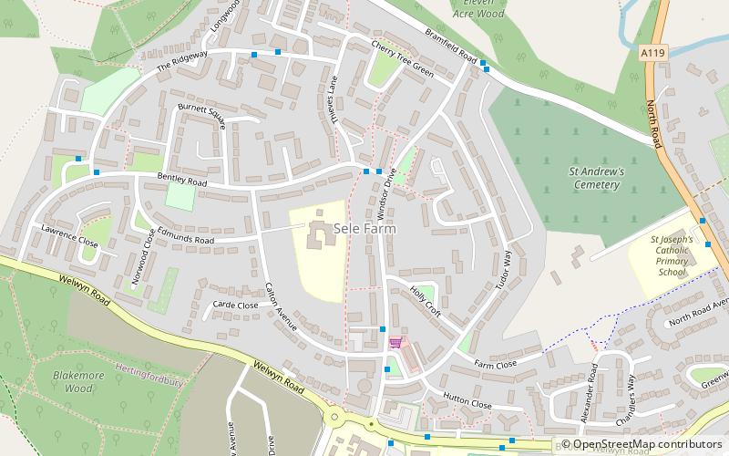
Sele Farm, Hertford
Carte
Faits et informations pratiques
Sele Farm est une zone à l'extrémité nord-ouest de Hertford, Hertfordshire.
Coordonnées: 51°48'7"N, 0°6'8"W
Adresse
Hertford
ContactAjouter
Médias sociaux
Ajouter
Accès par les transports publics
Arrêts de transport public à proximité du site
- Autobus
- Chemin de fer
 Autobus
- Déterminer l'itinéraireFordwich Rise 7 min. de marche
- Déterminer l'itinéraireHertford North Railway Station 13 min. de marche
- Déterminer l'itinéraireCounty Hospital 18 min. de marche
- Déterminer l'itinéraireHertford North 13 min. de marche
Excursions d'une journée


Foire aux questions (FAQ)
Comment s'y rendre par les transports publics ?
Stations et arrêts à proximité de Sele Farm :
Autobus
Chemin de fer
Autobus
- Fordwich Rise • Lignes: 724 (7 min. de marche)
- Hertford North Railway Station • Lignes: 724 (13 min. de marche)
Chemin de fer
- Hertford North (13 min. de marche)