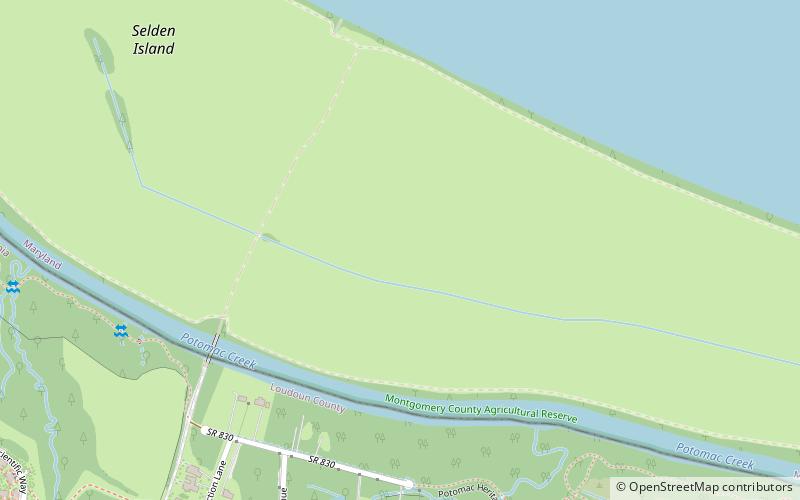
Selden Island
Fakty i informacje praktyczne
Selden Island to wyspa o powierzchni 408 akrów na rzece Potomac, położona około 32 km na północny zachód od Waszyngtonu. Ma około 4 km długości i 0,4-0,5 km szerokości. Chociaż znajduje się na terenie hrabstwa Montgomery w stanie Maryland, jedyny dostęp drogowy do niej zapewnia most łączący ją z brzegiem rzeki w hrabstwie Loudoun w stanie Wirginia.
Dowody archeologiczne wskazują, że wyspa była miejscem działalności człowieka od wczesnego okresu Woodland, około 1000 r. p.n.e. Z tego okresu pochodzi charakterystyczny typ ceramiki znany jako Selden Island ware. Jest to również miejsce ważnej osady z późnego okresu Woodland, znanej jako Prehistoryczna Wioska Walker, która została wpisana do Krajowego Rejestru Miejsc Historycznych w 1975 roku.
W 2002 roku, po zdiagnozowaniu malarii u dwóch nastolatków z hrabstwa Loudoun, okazało się, że komary z wyspy przenoszą pasożyta malarycznego Plasmodium vivax.
W 2004 r. wyspa Selden została zakupiona przez Instytut Medyczny Howarda Hughesa jako dodatek do kampusu badawczego Janelia Farm. Wcześniej była dzierżawiona jako farma sodowa.
Maryland
Selden Island – popularne w okolicy (odległości od atrakcji)
W pobliżu znajdują się m.in. takie atrakcje jak Dulles Town Center, Village at Leesburg, Park Regionalny Algonkian, Ball's Bluff Battlefield and National Cemetery.