Gauklerbrunnen, Dortmund


Datos e información práctica
Gauklerbrunnen es una atracción que se encuentra en Dortmund (estado federal Renania del Norte-Westfalia) y pertenece a la categoría de fuente, pozo.
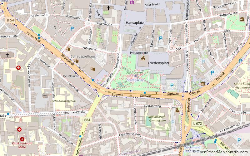
Está situado a una altitud de 331 pies, y sus coordenadas geográficas son 51°30'38"N de latitud y 7°27'50"E de longitud.
Al planificar una visita a este lugar, se puede llegar fácil y cómodamente utilizando el transporte público. Gauklerbrunnen se encuentra a una corta distancia de las siguientes estaciones de transporte público: Stadtgarten (tranvías, 1 min. a pie), Stadtgarten (metro, 1 min. a pie), Stadtgarten/Berswordthalle (autobuses, 2 min. a pie), Dortmund Stadthaus (ferrocarril, 8 min. a pie).
Entre otros lugares y atracciones que vale la pena visitar en la zona se incluyen: Stadtgarten (park, 1 min. a pie), Bierkutscher (monumentos y estatuas, 2 min. a pie), City Hall (ayuntamiento, 2 min. a pie).
Innenstadt-West (City-Ost)Dortmund
Gauklerbrunnen – popular en la zona (distancia de esta atracción)
En las cercanías se encuentran, entre otras, atracciones como: Westenhellweg, Deutsches Fußballmuseum, St. Reinold's Church, Torre U de Dortmund.
Preguntas frecuentes (FAQs)
¿Qué atracciones populares hay cerca?
¿Cómo llegar en transporte público?
Tranvías
- Stadtgarten • Líneas: U41, U45, U47, U49 (1 min. a pie)
- Dortmund-Stadthaus • Líneas: U41, U45, U47, U49 (8 min. a pie)
Metro
- Stadtgarten (1 min. a pie)
- Städtische Kliniken (8 min. a pie)
Autobuses
- Stadtgarten/Berswordthalle • Líneas: Ne7, Ne8 (2 min. a pie)
- Stadtgarten • Líneas: Ne7 (3 min. a pie)
Ferrocarril
- Dortmund Stadthaus (8 min. a pie)
- Estación Central de Dortmund (14 min. a pie)


