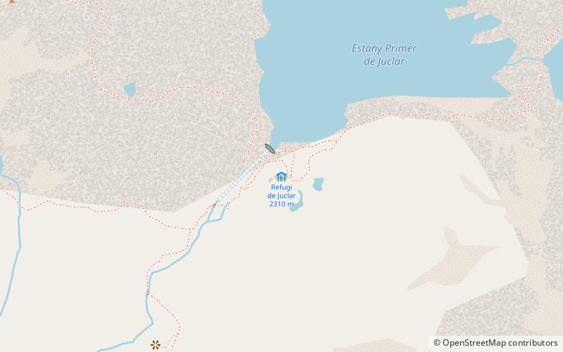
Trek Zone

Refugi de Juclar

#49 among destinations in Andorra

Hiking, Alpine hut
Refugi de Juclar

Facts and practical information

Refugi de Juclar is a place located in Andorra and belongs to the category of hiking, alpine hut.

It is situated at an altitude of 7569 feet, and its geographical coordinates are 42°36'27"N latitude and 1°42'56"E longitude.

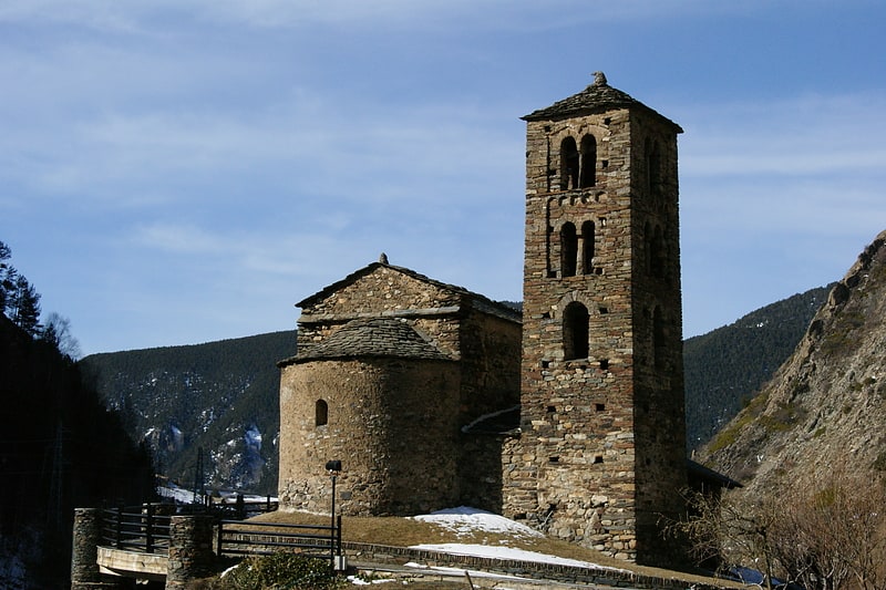
Among other places and attractions worth visiting in the area are: Església de Sant Bartomeu de SoldeuSoldeu (church, 83 min walk), Mountain Hostel TarterEl Tarter (hostel, 95 min walk), RansolEl Tarter (village, 111 min walk).

Coordinates: 42°36'27"N, 1°42'56"E
Location

CanilloAndorra

Contact
Social media
Add

Refugi de Juclar plan & book

Unleash the traveler in you — discover the cheapest flight deals, find the perfect hotel or hostel nearby, and search for the best car rental prices. Travel at your own pace to discover new places and enjoy your journey.

Day trips

Refugi de Juclar – popular in the area (distance from the attraction)

Nearby attractions include: Grau Roig, Sant Joan de Caselles, Grans Magatzems Pyrénées, Església de Sant Bartomeu de Soldeu.

  • grau roig5.2 miS
  • sant joan de caselles canillo6 miSW
  • grans magatzems pyrenees pas de la casa location map
    4.5 miS
  • esglesia de sant bartomeu de soldeu3.2 miSW
  • mountain hostel tarter el tarter3.7 miSW
  • port denvalira pas de la casa4.7 miS
  • ransol el tarter4.4 miSW

Where to next? Visit canillo Canillo region page or discover the top tourist attractions in Andorra.