El Palmar National Park

Facts and practical information
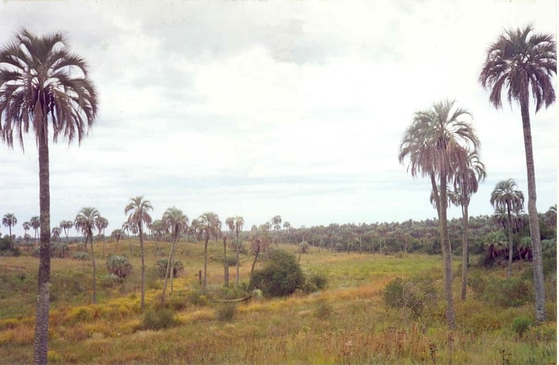
El Palmar National Park, located in the Entre Ríos region of Argentina, is a stunning natural gem that offers visitors a unique opportunity to immerse themselves in the beauty of the country's diverse landscape. The park is renowned for its picturesque palm groves, which are a rare sight in the region and create a truly enchanting atmosphere.
One of the main attractions of El Palmar National Park is the opportunity to explore its extensive network of hiking trails, which wind their way through the palm groves and offer breathtaking views of the surrounding scenery. Whether you're an experienced hiker looking for a challenge or a casual stroller hoping to soak in the natural beauty, the park has something for everyone.
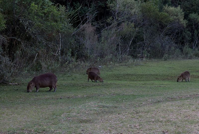
In addition to its natural beauty, the park is also home to a diverse array of wildlife, including capybaras, deer, and a wide variety of bird species. Birdwatching enthusiasts will be particularly delighted by the chance to spot some of the park's rare and exotic avian inhabitants.
For those seeking a more immersive experience, El Palmar National Park also offers camping facilities, allowing visitors to spend a night under the stars in the heart of this breathtaking natural environment. There are also picnic areas and barbecue spots, making it the perfect place for a family day out.
Entre Ríos
Best Ways to Experience the Park
Wildlife
AnimalsSee what popular animal species you can meet in this location.

Peregrine falcon
The peregrine falcon, a member of the Falconidae family, is celebrated for its astonishing speed and hunting prowess. It can reach speeds exceeding 320 km/h (200 mph) during its iconic dive, known as a stoop, making it the fastest bird and animal on Earth.
Birds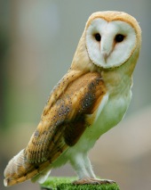
Barn owl
The barn owl, often referred to as the common barn owl, is a captivating bird found across almost every continent, excluding polar and desert regions, certain parts of Asia, Indonesia, and some Pacific islands. There are several subspecies of barn owls, each varying in...
Birds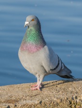
Rock dove
The rock dove, commonly known as the rock pigeon, or simply pigeon, is a familiar bird belonging to the Columbidae family. Most pigeons seen in cities today are descendants of domesticated rock doves that escaped, forming feral populations worldwide.
Birds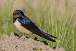
Barn swallow
The barn swallow is a bird that can be found all over the world, from Europe and Asia to Africa and the Americas. You can easily identify it by its striking blue upper feathers and deeply forked tail. Despite some declines in local populations, the barn swallow is not...
Birds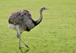
Greater rhea
The greater rhea, a flightless bird native to eastern South America, holds the distinction of being the largest bird on the continent. These impressive birds weigh between 20 to 27 kilograms and stand about 1.5 meters tall.
Birds