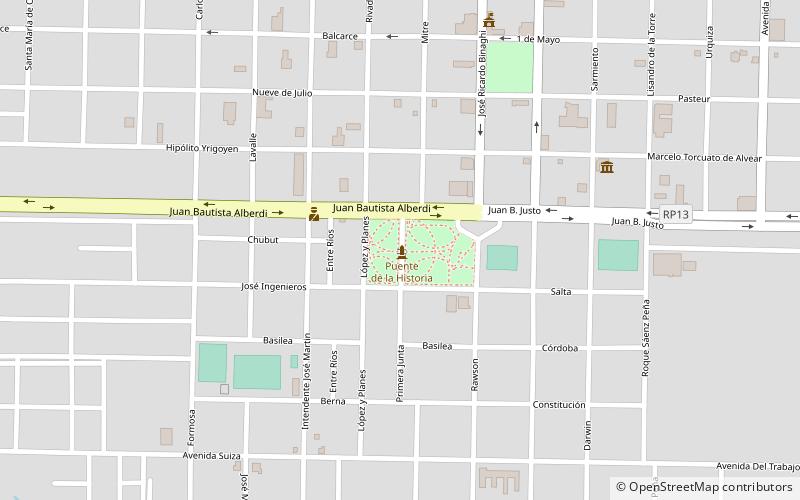
Puente de la Historia, Villa Ángela
Map
Facts and practical information
Puente de la Historia is a place located in Villa Ángela (Chaco province) and belongs to the category of memorial.
It is situated at an altitude of 249 feet, and its geographical coordinates are 27°34'49"S latitude and 60°42'49"W longitude.
Among other places and attractions worth visiting in the area are: Parque Infantil Eva Duarte de Perón (memorial, 10 min walk), Rotonda de la Democracia (memorial, 19 min walk), Paseo Luis Landriscina (memorial, 22 min walk).
Coordinates: 27°34'49"S, 60°42'49"W
Address
Villa Ángela
ContactAdd
Social media
Add
Day trips
Frequently Asked Questions (FAQ)
Which popular attractions are close to Puente de la Historia?
Nearby attractions include Parque Infantil Eva Duarte de Perón, Villa Ángela (10 min walk), Rotonda de la Democracia, Villa Ángela (19 min walk), Paseo Luis Landriscina, Villa Ángela (22 min walk).