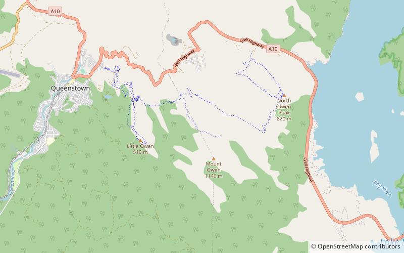
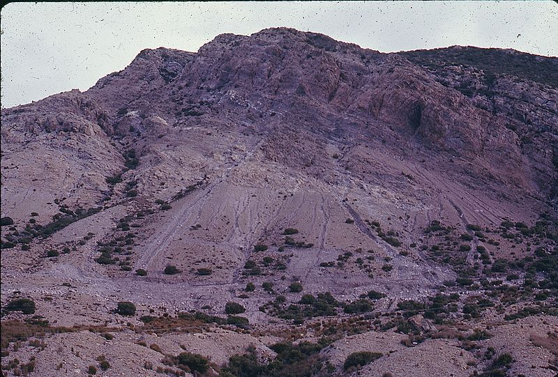
Mount Owen
#1325 among destinations in Australia
![Mount Owen location map](https://tzmedia.b-cdn.net/media/images/static-maps/au/-42_09_145_60001.jpg)
![Mount Owen](https://tzmedia.b-cdn.net/media/images/au/place/gallery/medium/0046a0bb4f2d67f160bfd95e389fc845.jpg)
Facts and practical information
Mount Owen is a mountain directly east of the town of Queenstown on the West Coast Range in Western Tasmania, Australia. ()
TasmaniaAustralia
Mount Owen plan & book
Unleash the traveler in you — discover the cheapest flight deals, find the perfect hotel or hostel nearby, and search for the best car rental prices. Travel at your own pace to discover new places and enjoy your journey.
Mount Owen – popular in the area (distance from the attraction)
Nearby attractions include: Lake Burbury, Galley Museum, Mount Huxley, Mount Lyell.
3.6 miSENature, LakeLake Burbury
93 min walk • Lake Burbury is a man-made water reservoir created by the Crotty Dam inundating the upper King River valley that lies east of the West Coast Range.
2.3 miWSpecialty museum, MuseumGalley Museum, Queenstown
60 min walk • The Eric Thomas Galley Museum is a photographic and general museum in Driffield Street in Queenstown. One of two west coast Tasmania museums that house records and relics from the mining communities of the past, the museum is housed in a former 1897 constructed Imperial Hotel, which has also been a mining office and Youth Hostel.
3.5 miSNature, Natural attraction, MountainMount Huxley
91 min walk • Mount Huxley is a mountain located on the West Coast Range in the West Coast region of Tasmania, Australia. With an elevation of 926 metres above sea level, the mountain was named by Charles Gould in 1863 in honour of Professor Thomas Henry Huxley.
2.8 miNNature, Natural attraction, MountainMount Lyell
73 min walk • Mount Lyell is a mountain in the West Coast Range of Western Tasmania, Australia. Mount Lyell has an elevation of 917 metres above sea level. The adjacent mountains are Mount Sedgwick to the north and Mount Owen to the south. The mountain was named by Charles Gould in 1863 after geologist Charles Lyell, a supporter of Charles Darwin.
5.6 miSNature, Natural attraction, MountainMount Jukes
144 min walk • Mount Jukes is a mountain located on the Jukes Range, a spur off the West Coast Range, in the West Coast region of Tasmania, Australia.
4.9 miSDamCrotty Dam
125 min walk • The Crotty Dam, also known during construction as the King Dam, or the King River Dam on initial approval, is a rockfill embankment dam with a controlled and uncontrolled spillway across the King River, between Mount Jukes and Mount Huxley, located in Western Tasmania, Australia.
2.3 miWNeighbourhoodQueenstown Post Office, Queenstown
60 min walk • Queenstown Post Office is a heritage-listed post office at 32-34 Orr Street, Queenstown, Tasmania, Australia. It was designed by the Tasmanian government's Public Works Office and built in 1902, with the tower added in 1909. It was added to the Australian Commonwealth Heritage List on 22 June 2004.
2.3 miNWSport, Sport venueQueenstown Oval, Queenstown
60 min walk • Queenstown Oval, known colloquially as The Gravel or The Rec, is a sports arena in Queenstown, located on the west coast of Tasmania.