Tea Gardens-Hawks Nest Bridge, Hawks Nest

Gallery (1)
Map
Map
Facts and practical information
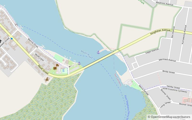
The Tea Gardens-Hawks Nest Bridge is a road bridge that carries Myall Street across the Myall River, connecting the two townships of Tea Gardens and Hawks Nest in the Mid-Coast Council local government area in the Mid North Coast region of New South Wales, Australia. ()
Opened: 1974 (52 years ago)Length: 998 ftWidth: 34 ftCoordinates: 32°40'9"S, 152°10'5"E
Day trips