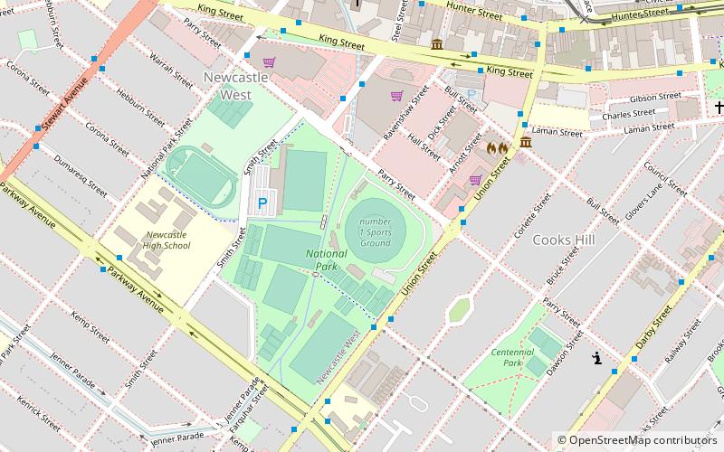
Newcastle Number 1 Sports Ground, Newcastle
Map
Facts and practical information
Number 1 Sports Ground is a multi-use stadium located in Newcastle, New South Wales, and has a nominated capacity of approximately 20,000. ()
Coordinates: 32°55'53"S, 151°45'47"E
Address
Newcastle
ContactAdd
Social media
Add
Getting there by public transportation
Public transportation stops near this location
- Bus
- Light rail
- Train
- Ferry
 Bus
Bus
- Calculate routeUnion St Near Tooke St 4 min walk
- Calculate routeSteel St Near Parry St 5 min walk
- Calculate routeMarketown Shopping Centre, Steel St 5 min walk
- Calculate routeHoneysuckle 10 min walk
- Calculate routeNewcastle Interchange 14 min walk
- Calculate routeCivic 16 min walk
- Calculate routeCrown Street 23 min walk
- Calculate routeNewcastle Interchange 14 min walk
- Calculate routeHamilton 31 min walk
- Calculate routeNewcastle Wharf 28 min walk
Day trips


Frequently Asked Questions (FAQ)
Which popular attractions are close to Newcastle Number 1 Sports Ground?
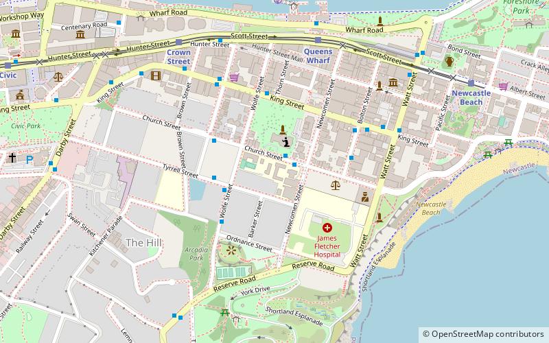
Nearby attractions include Miss Porter's House, Newcastle (7 min walk), St John's Anglican Church, Newcastle (10 min walk), Pinnacle Apartments, Newcastle (11 min walk), Newcastle City Hall, Newcastle (15 min walk).
How to get to Newcastle Number 1 Sports Ground by public transport?
The nearest stations to Newcastle Number 1 Sports Ground:
Bus
Light rail
Train
Ferry
Bus
- Union St Near Tooke St • Lines: 12 (4 min walk)
- Steel St Near Parry St • Lines: 12 (5 min walk)
Light rail
- Honeysuckle • Lines: L (10 min walk)
- Newcastle Interchange • Lines: L (14 min walk)
Train
- Newcastle Interchange (14 min walk)
- Hamilton (31 min walk)
Ferry
- Newcastle Wharf • Lines: Newcastle - Stockton Ferry (28 min walk)