Port Macquarie Regional Stadium, Port Macquarie
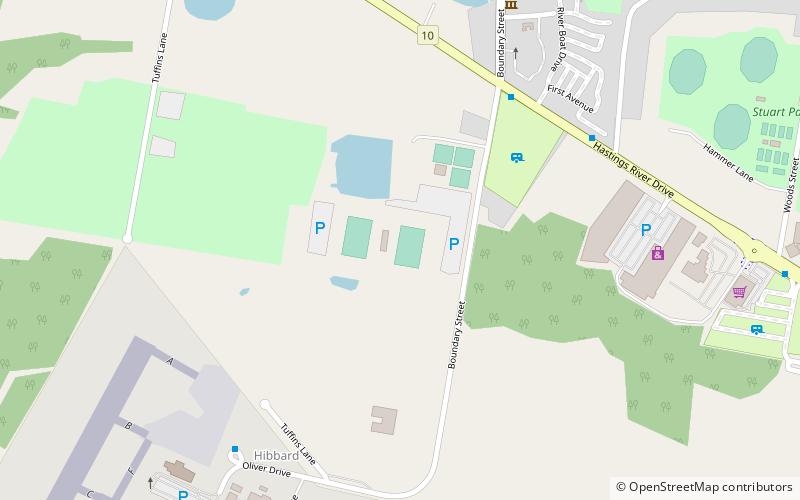
Map
Facts and practical information
The Port Macquarie Regional Sports Stadium was constructed in 1992 with funding assistance by NSW Sport & Recreation, NSW Country Rugby League and Hastings Council, making the venue become a primary location of rugby league in the New South Wales' North Coast region. The venue is managed by Port Macquarie Hastings Council. ()
Opened: 1992 (34 years ago)Capacity: 10 thous.Coordinates: 31°25'38"S, 152°52'19"E
Address
Port Macquarie
ContactAdd
Social media
Add
Getting there by public transportation
Public transportation stops near this location
- Bus
 Bus
Bus
- Calculate routeBellbowrie Street at Denham Street 30 min walk
- Calculate routeWidderson Street at Phillip Street 32 min walk
Day trips


Frequently Asked Questions (FAQ)
How to get to Port Macquarie Regional Stadium by public transport?
The nearest stations to Port Macquarie Regional Stadium:
Bus
Bus
- Bellbowrie Street at Denham Street • Lines: 334K (30 min walk)
- Widderson Street at Phillip Street • Lines: 334K (32 min walk)