Acland Street, Melbourne

Gallery (3)
Map

Map
Gallery
Facts and practical information
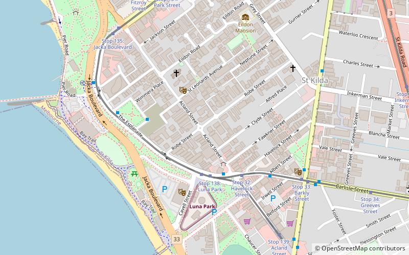
Acland Street is a street in the Melbourne suburb of St Kilda, which enjoys great popularity as a recreational area, mainly due to its many restaurants and its proximity to the entertainment areas along St Kilda beach ()
Coordinates: 37°51'55"S, 144°58'37"E
Address
Port Phillip (St. Kilda)Melbourne
ContactAdd
Social media
Add
Getting there by public transportation
Public transportation stops near this location
- Bus
- Tram
- Train
 Bus
Bus
- Calculate routeStop 138: Luna Park 3 min walk
- Calculate routeStop 32: Havelock Street 4 min walk
- Calculate routeStop 136: The Esplanade 5 min walk
- Calculate routeStop 33: Barkly Street 7 min walk
- Calculate routeLuna Park, Acland Street 3 min walk
- Calculate routeAlfred Square 6 min walk
- Calculate routeNational Theatre 7 min walk
- Calculate routeVictoria Street 7 min walk
- Calculate routeBalaclava 25 min walk
- Calculate routeWindsor 27 min walk
- Calculate routeRipponlea 32 min walk
- Calculate routePrahran 33 min walk
Maps Melbourne TramsMaps
 Victoria Trains
Melbourne TramsMapsVictoria TrainsDay trips


Frequently Asked Questions (FAQ)
Which popular attractions are close to Acland Street?
Nearby attractions include Palais Theatre, Melbourne (5 min walk), Alfred Square, Melbourne (5 min walk), National Theatre, Melbourne (7 min walk), Sacred Heart Church St Kilda, Melbourne (7 min walk).
How to get to Acland Street by public transport?
The nearest stations to Acland Street:
Tram
Bus
Train
Tram
- Stop 138: Luna Park • Lines: 16, 16d, 3a, 96, 96d (3 min walk)
- Stop 32: Havelock Street • Lines: 16, 3a (4 min walk)
Bus
- Luna Park, Acland Street • Lines: 606, 623 (3 min walk)
- Alfred Square • Lines: 606 (6 min walk)
Train
- Balaclava (25 min walk)
- Windsor (27 min walk)