St Philip's Anglican Church Kingswood, Sydney
Map
Facts and practical information
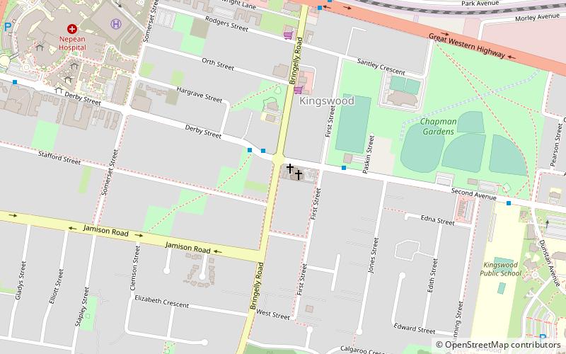
St. Phillip's Anglican Church Kingswood is an Anglican church at the corner of Bringelly Road and Second Avenue in Kingswood, a western suburb of Sydney, New South Wales, Australia. It was completed in 1896 and is a modest late-Victorian Gothic Revival building constructed in brick comprising a nave, chancel, and porch. The church was listed on the City of Penrith local government heritage register on 20 December 1991. ()
Coordinates: 33°45'48"S, 150°43'12"E
Getting there by public transportation
Public transportation stops near this location
- Bus
- Train
 Bus
Bus
- Calculate routeKingswood 9 min walk
- Calculate routeWestern Shuttle Bus Stop 15 min walk
Maps Sydney TrainsMaps
 Sydney Light RailMaps
 Sydney Ferries
Sydney TrainsMapsSydney Light RailMapsSydney FerriesDay trips
St Philip's Anglican Church Kingswood – popular in the area (distance from the attraction)
Nearby attractions include: Westfield Penrith, Sydney International Regatta Centre, Penrith Whitewater Stadium, Museum of Fire.


Frequently Asked Questions (FAQ)
How to get to St Philip's Anglican Church Kingswood by public transport?
The nearest stations to St Philip's Anglican Church Kingswood:
Train
Bus
Train
- Kingswood (9 min walk)
Bus
- Western Shuttle Bus Stop (15 min walk)