Jessie Street Gardens, Sydney
Map
Facts and practical information
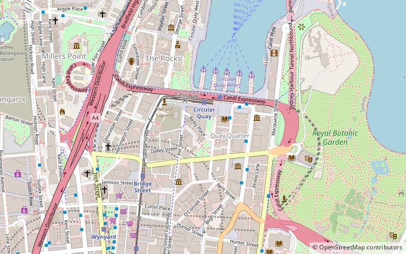
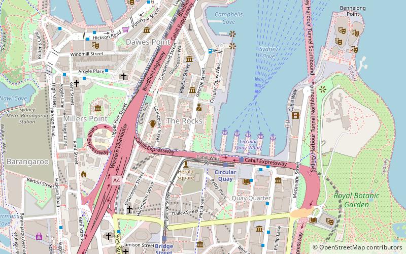
The Jessie Street Gardens is an urban park in Loftus Street, in the Sydney central business district, near Circular Quay, Sydney, New South Wales, Australia. The park is named in honour of Jessie Street, a leading Australian women's rights activist. ()
Opened: 7 December 1990 (35 years ago)Coordinates: 33°51'45"S, 151°12'36"E
Getting there by public transportation
Public transportation stops near this location
- Bus
- Light rail
- Train
- Ferry
 Bus
Bus
- Calculate routeCircular Quay 2 min walk
- Calculate routeBridge Street 5 min walk
- Calculate routeWynyard 9 min walk
- Calculate routeQvb 18 min walk
- Calculate routeCircular Quay 3 min walk
- Calculate routeWynyard 9 min walk
- Calculate routeMartin Place 10 min walk
- Calculate routeSt James 16 min walk
- Calculate routeStand A, Circular Quay, Alfred Street 3 min walk
- Calculate routeStand C, Phillip Street 3 min walk
- Calculate routeCircular Quay 4 min walk
- Calculate routeMuseum of Sydney 4 min walk
- Calculate routeCircular Quay Wharf 5 4 min walk
- Calculate routeCircular Quay Wharf 4 4 min walk
- Calculate routeCircular Quay Wharf 3 5 min walk
- Calculate routeCircular Quay Wharf 2 5 min walk
Maps Sydney TrainsMaps
 Sydney Light RailMaps
 Sydney Ferries
Sydney TrainsMapsSydney Light RailMapsSydney FerriesDay trips


Frequently Asked Questions (FAQ)
Which popular attractions are close to Jessie Street Gardens?
Nearby attractions include City of Sydney Library, Sydney (2 min walk), Hinchcliff House, Sydney (2 min walk), Macquarie Place Park, Sydney (2 min walk), Customs House, Sydney (2 min walk).
How to get to Jessie Street Gardens by public transport?
The nearest stations to Jessie Street Gardens:
Light rail
Train
Bus
Ferry
Light rail
- Circular Quay • Lines: L2, L3 (2 min walk)
- Bridge Street • Lines: L2, L3 (5 min walk)
Train
- Circular Quay (3 min walk)
- Wynyard (9 min walk)
Bus
- Stand A, Circular Quay, Alfred Street • Lines: 302, 303, 326 (3 min walk)
- Stand C, Phillip Street • Lines: M52 (3 min walk)
Ferry
- Circular Quay Wharf 5 • Lines: F3, F4 (4 min walk)
- Circular Quay Wharf 4 • Lines: F5, F6 (4 min walk)