St. Columb's Anglican Church, Melbourne
Map
Facts and practical information
St Columb's Anglican Church is an Anglican church in Hawthorn, Victoria, a suburb of Melbourne in Australia. ()
Coordinates: 37°49'26"S, 145°2'23"E
Getting there by public transportation
Public transportation stops near this location
- Bus
- Tram
- Train
 Bus
Bus
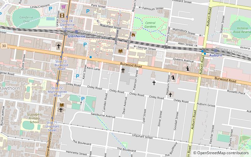
- Calculate routeStop 72: Oxley Road 7 min walk
- Calculate routeStop 73: Burwood Road 7 min walk
- Calculate routeStop 72: Manningtree Road 7 min walk
- Calculate routeStop 74: Glenferrie Station 8 min walk
- Calculate routeGlenferrie 7 min walk
- Calculate routeAuburn 9 min walk
- Calculate routeHawthorn 24 min walk
- Calculate routeCamberwell 27 min walk
- Calculate routeAuburn Station/Auburn Rd 8 min walk
- Calculate routeRiversdale Road 13 min walk
- Calculate routeHawthorn Station 23 min walk
Maps Melbourne TramsMaps
 Victoria Trains
Melbourne TramsMapsVictoria TrainsDay trips


Frequently Asked Questions (FAQ)
Which popular attractions are close to St. Columb's Anglican Church?
Nearby attractions include Hawthorn Arts Centre, Melbourne (6 min walk), Victorian Telecommunications Museum, Melbourne (6 min walk), Melbourne Tram Museum, Melbourne (23 min walk).
How to get to St. Columb's Anglican Church by public transport?
The nearest stations to St. Columb's Anglican Church:
Tram
Train
Bus
Tram
- Stop 72: Oxley Road • Lines: 16, 16d (7 min walk)
- Stop 73: Burwood Road • Lines: 16, 16d (7 min walk)
Train
- Glenferrie (7 min walk)
- Auburn (9 min walk)
Bus
- Auburn Station/Auburn Rd • Lines: 624 (8 min walk)
- Riversdale Road • Lines: 624 (13 min walk)