Albert Cotter Bridge, Sydney
Map

Map

Facts and practical information
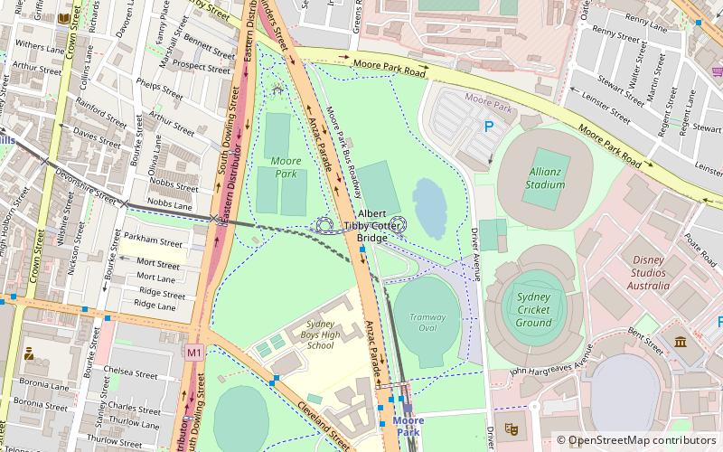
The Albert Cotter Bridge, also known as the Tibby Cotter bridge, is a pedestrian bridge across Anzac Parade, Sydney, New South Wales, Australia. It was built to primarily to cater for crowds exiting the Sydney Cricket Ground and Sydney Football Stadium. ()
Coordinates: 33°53'24"S, 151°13'15"E
Address
South Sydney (Moore Park)Sydney
ContactAdd
Social media
Add
Day trips
Albert Cotter Bridge – popular in the area (distance from the attraction)
Nearby attractions include: Sydney Cricket Ground, Fox Studios Australia, The Entertainment Quarter, Sydney Cricket Ground Members' Stand and Lady Members' Stand.
Frequently Asked Questions (FAQ)
Which popular attractions are close to Albert Cotter Bridge?
Nearby attractions include Sydney Cricket Ground Members' Stand and Lady Members' Stand, Sydney (6 min walk), Sydney Cricket Ground, Sydney (7 min walk), Korean War Memorial, Sydney (7 min walk), Victoria Barracks, Sydney (9 min walk).
How to get to Albert Cotter Bridge by public transport?
The nearest stations to Albert Cotter Bridge:
Light rail
Bus
Train
Light rail
- Moore Park • Lines: L2, L3 (7 min walk)
- Surry Hills • Lines: L2, L3 (14 min walk)
Bus
- Surry Hills, Cleveland Street nr Crown Street • Lines: 301 (13 min walk)
- Bourke Street Nr Phillip Street, Waterloo • Lines: 301 (19 min walk)
Train
- Central (25 min walk)
- Kings Cross (28 min walk)

 Sydney Trains
 Sydney Light Rail
 Sydney Ferries


