Tonsley, Adelaide
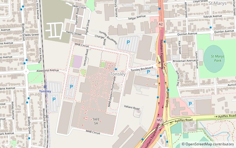
Map
Facts and practical information
Tonsley is a southern suburb of Adelaide, the capital city of South Australia. ()
Coordinates: 35°0'30"S, 138°34'21"E
Address
Clovelly ParkAdelaide
ContactAdd
Social media
Add
Getting there by public transportation
Public transportation stops near this location
- Bus
- Train
 Bus
Bus
- Calculate routeTonsley 8 min walk
- Calculate routeMitchell Park 14 min walk
- Calculate routeFlinders 20 min walk
- Calculate routeMarion 33 min walk
- Calculate routeFlinders Medical Centre Interchange 25 min walk
- Calculate routeFlinders University Interchange 30 min walk
- Calculate routeZone B Registry Road - Flinders University 30 min walk
Day trips


Frequently Asked Questions (FAQ)
How to get to Tonsley by public transport?
The nearest stations to Tonsley:
Train
Bus
Train
- Tonsley (8 min walk)
- Mitchell Park (14 min walk)
Bus
- Flinders Medical Centre Interchange (25 min walk)
- Flinders University Interchange (30 min walk)