Sint-Eligius, Kortrijk

Gallery (1)
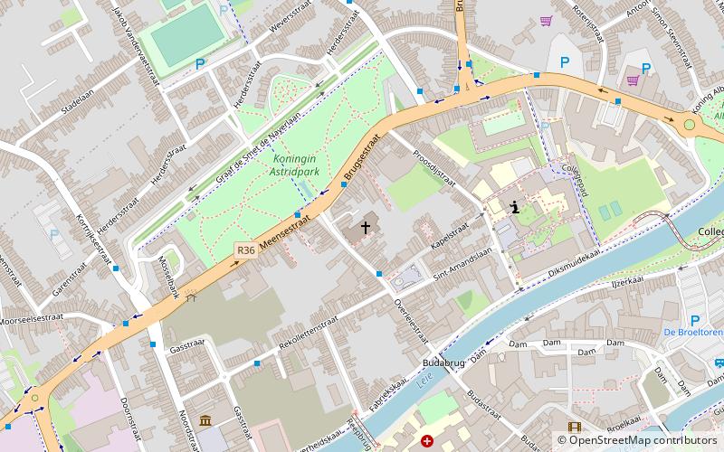
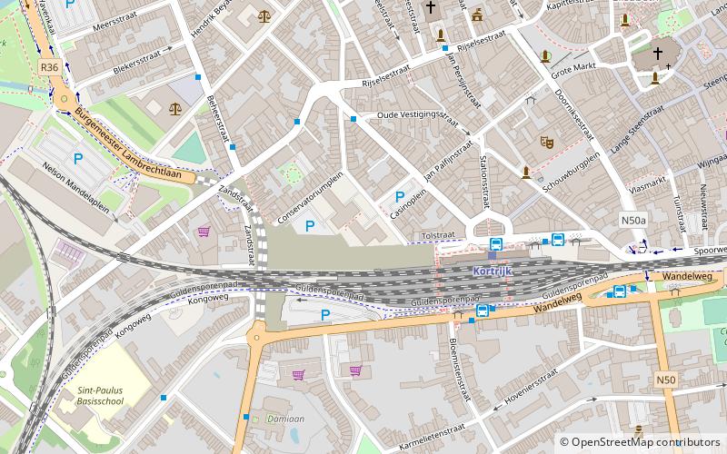
Map
Map
Facts and practical information
Sint-Eligius is a place located in Kortrijk (Vlaanderen region) and belongs to the category of church, architecture.
It is situated at an altitude of 52 feet, and its geographical coordinates are 50°50'1"N latitude and 3°15'35"E longitude.
Planning a visit to this place, one can easily and conveniently get there by public transportation. Sint-Eligius is a short distance from the following public transport stations: Kortrijk Sint-Jansput (bus, 2 min walk), Kortrijk (train, 17 min walk).
Among other places and attractions worth visiting in the area are: Astridpark (playground, 5 min walk), Broelmuseum (specialty museum, 9 min walk), Broeltowers (tower, 10 min walk).
Coordinates: 50°50'1"N, 3°15'35"E
Address
Kortrijk
ContactAdd
Social media
Add
Getting there by public transportation
Public transportation stops near this location
- Bus
- Train
 Bus
Bus
- Calculate routeKortrijk Sint-Jansput 2 min walk
- Calculate routeKortrijk Sint-Amandsplein 2 min walk
- Calculate routeKortrijk 17 min walk
Day trips


Frequently Asked Questions (FAQ)
Which popular attractions are close to Sint-Eligius?
Nearby attractions include Astridpark, Kortrijk (5 min walk), Broelmuseum, Kortrijk (9 min walk), Broeltowers, Kortrijk (10 min walk), Sint-Michielskerk, Kortrijk (11 min walk).
How to get to Sint-Eligius by public transport?
The nearest stations to Sint-Eligius:
Bus
Train
Bus
- Kortrijk Sint-Jansput • Lines: 52, 53, 6 (2 min walk)
- Kortrijk Sint-Amandsplein • Lines: 6 (2 min walk)
Train
- Kortrijk (17 min walk)