Sint-Jozefskerk, Ostend

Gallery (1)
Map
Map
Facts and practical information
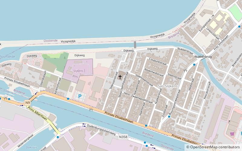
Sint-Jozefskerk is a place located in Ostend (Vlaanderen region) and belongs to the category of church.
It is situated at an altitude of 7 feet, and its geographical coordinates are 51°13'24"N latitude and 2°57'19"E longitude.
Planning a visit to this place, one can easily and conveniently get there by public transportation. Sint-Jozefskerk is a short distance from the following public transport stations: Bredene Centrale (bus, 4 min walk), Stop (tram, 30 min walk).
Among other places and attractions worth visiting in the area are: Explorado (museum, 33 min walk), Port of Ostend (harbor, 33 min walk), Lange Nelle (lighthouse, 36 min walk).
Coordinates: 51°13'24"N, 2°57'19"E
Address
Ostend
ContactAdd
Social media
Add
Getting there by public transportation
Public transportation stops near this location
- Bus
- Tram
 Bus
Bus
- Calculate routeBredene Centrale 4 min walk
- Calculate routeOostende Ostend Stores 6 min walk
- Calculate routeStop 30 min walk
- Calculate routeOostende Weg Naar Vismijn 18 min walk
Day trips


Frequently Asked Questions (FAQ)
How to get to Sint-Jozefskerk by public transport?
The nearest stations to Sint-Jozefskerk:
Bus
Tram
Bus
- Bredene Centrale • Lines: 35, 4, 46, 89, 9 (4 min walk)
- Oostende Ostend Stores • Lines: 54 (6 min walk)
Tram
- Stop • Lines: (30 min walk)
- Oostende Weg Naar Vismijn • Lines: (18 min walk)