Rio Ivinhema State Park
Facts and practical information
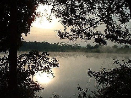
Nestled in the Mato Grosso do Sul region of Brazil, Rio Ivinhema State Park is a nature lover's paradise. This expansive state park is home to lush forests, crystal-clear rivers, and diverse wildlife, making it the perfect destination for those seeking an outdoor adventure.
Visitors to Rio Ivinhema State Park can explore the park's many hiking trails, which wind through dense forests and lead to stunning viewpoints overlooking the park's rivers and waterfalls. The park is also a haven for birdwatchers, with over 300 species of birds calling the area home. Lucky visitors may even catch a glimpse of the elusive jaguar, which roams the park's remote areas.
For those looking to cool off, Rio Ivinhema State Park offers plenty of opportunities for water-based activities. The park's rivers are ideal for kayaking and canoeing, allowing visitors to paddle through pristine waters and take in the park's scenic beauty from a unique perspective. Fishing is also a popular pastime in the park, with an abundance of fish species inhabiting the rivers.
Camping is a popular way to experience Rio Ivinhema State Park, allowing visitors to immerse themselves in the sights and sounds of the park's natural surroundings. The park offers designated camping areas equipped with basic facilities, providing a comfortable base for exploring the park's many attractions.
Mato Grosso do Sul