Freguesia do Ó, São Paulo
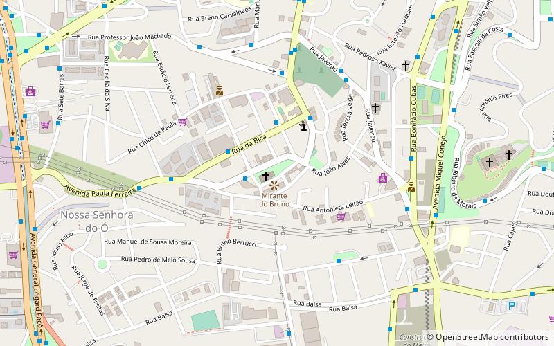
Map
Facts and practical information
Freguesia do Ó is one of 96 districts in the city of São Paulo, Brazil. ()
Address
Freguesia-Brasilândia (Freguesia do Ó)São Paulo
ContactAdd
Social media
Add
Getting there by public transportation
Public transportation stops near this location
- Bus
- Train
 Bus
Bus
- Calculate routeAvenida Paula Ferreira, 216 2 min walk
- Calculate routeRua Coronel Tristão, 115 3 min walk
- Calculate routeRua Da Bica, 259 3 min walk
- Calculate routePiqueri 27 min walk
- Calculate routeLapa 30 min walk
Maps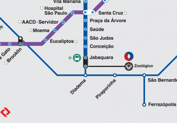 Metro / Suburban rail
Metro / Suburban railDay trips


Frequently Asked Questions (FAQ)
How to get to Freguesia do Ó by public transport?
The nearest stations to Freguesia do Ó:
Bus
Train
Bus
- Avenida Paula Ferreira, 216 • Lines: 178T-10 (2 min walk)
- Rua Coronel Tristão, 115 • Lines: 178T-10 (3 min walk)
Train
- Piqueri (27 min walk)
- Lapa (30 min walk)