Lanmadaw Township, Yangon

Map
Facts and practical information
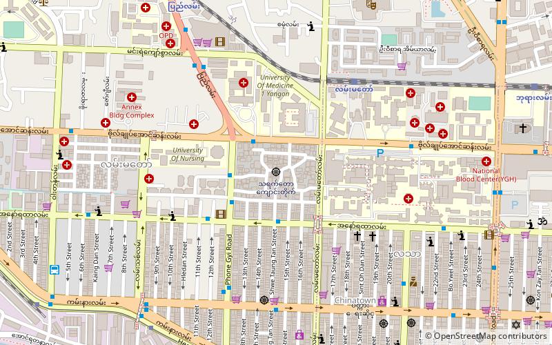
Lanmadaw Township is located in the western part of downtown Yangon, and shares borders with Ahlon Township in the west, Latha Township in the east, Seikkan Township and Yangon River in the south, and Dagon Township in the north. It consists of twelve wards and is home to five primary schools, two middle schools and two high schools. Lanmadaw and Latha townships make up the Yangon Chinatown. ()
Address
Downtown (Latha)Yangon
ContactAdd
Social media
Add
Getting there by public transportation
Public transportation stops near this location
- Bus
- Ferry
 Bus
Bus
- Calculate routeSay Yone Gyi 3 min walk
- Calculate routeThayet Taw Kyaung 8 min walk
- Calculate routeLatha Lann 8 min walk
- Calculate routeLay Har Pyin Zayy Bus Stop 8 min walk
- Calculate routeLan Thit Jetty 20 min walk
- Calculate routeDala Ferry Station 28 min walk
- Calculate routeNan Thida Ferry Station 31 min walk
- Calculate routeNan Thida Terminal 32 min walk
Day trips


Frequently Asked Questions (FAQ)
Which popular attractions are close to Lanmadaw Township?
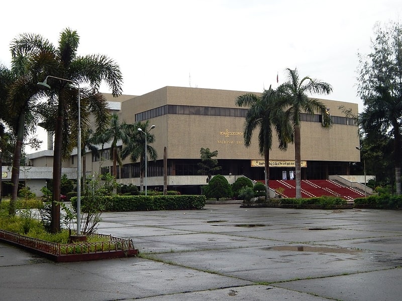
Nearby attractions include Dagon Township, Yangon (1 min walk), National Theatre of Yangon, Yangon (6 min walk), Thayettaw Monastery, Yangon (7 min walk), Holy Trinity Cathedral, Yangon (8 min walk).
How to get to Lanmadaw Township by public transport?
The nearest stations to Lanmadaw Township:
Bus
Ferry
Bus
- Say Yone Gyi • Lines: 37 Hlegu, 37 Htaukkyant, 37 TU Hmawbi, 37 Waryarlatt, 56, 8, 94 (3 min walk)
- Thayet Taw Kyaung • Lines: 37 Hlegu, 37 Htaukkyant, 37 TU Hmawbi, 37 Waryarlatt, 56, 94 (8 min walk)
Ferry
- Lan Thit Jetty • Lines: Ferry Route (Dala) - Dala -> Lat, Ferry route (Dala) - Latha -> Da, Insein, ဖယ်ရီ လမ်းကြောင်း (20 min walk)
- Dala Ferry Station • Lines: Ferry Route (Dala) - Dala -> Lat, Ferry route (Dala) - Latha -> Da (28 min walk)