Walterdale, Edmonton
Map
Facts and practical information
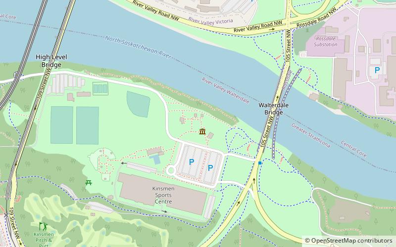
Walterdale is a former industrial and residential neighbourhood in Edmonton, Alberta, Canada within the North Saskatchewan River valley. It is located on the south shore of the river in an area now occupied by Kinsmen Park within a river valley neighbourhood named River Valley Walterdale. ()
Coordinates: 53°31'41"N, 113°30'18"W
Address
South Central Edmonton (River Valley Walterdale)Edmonton
ContactAdd
Social media
Add
Getting there by public transportation
Public transportation stops near this location
- Bus
- Light rail
 Bus
Bus
- Calculate routeGovernment Centre Transit Centre 15 min walk
- Calculate routeWhyte Ave & 106 Street 18 min walk
- Calculate routeGovernment Centre 16 min walk
- Calculate routeUniversity 19 min walk
- Calculate routeCorona 23 min walk
Day trips
Walterdale – popular in the area (distance from the attraction)
Nearby attractions include: Alberta Legislature Building, Indigenous Art Park, Dudley B. Menzies Bridge, Princess Theatre.


Frequently Asked Questions (FAQ)
Which popular attractions are close to Walterdale?
Nearby attractions include John Walter Museum, Edmonton (1 min walk), Walterdale Bridge, Edmonton (4 min walk), High Level Bridge, Edmonton (7 min walk), Indigenous Art Park, Edmonton (9 min walk).
How to get to Walterdale by public transport?
The nearest stations to Walterdale:
Bus
Light rail
Bus
- Government Centre Transit Centre (15 min walk)
- Whyte Ave & 106 Street • Lines: 4, 637, 7 (18 min walk)
Light rail
- Government Centre • Lines: 501, 502 (16 min walk)
- University • Lines: 501, 502 (19 min walk)