Deering Island Bridge, Vancouver
Map
Facts and practical information
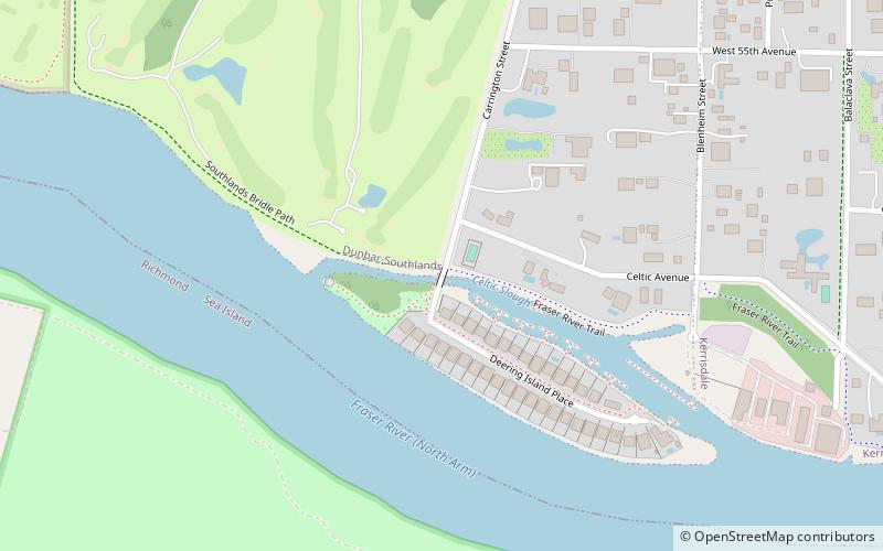
Deering Island Bridge is a short bridge in Vancouver, British Columbia connecting the city with Deering Island, a small residential community. It crosses the Fraser River. This is the only road connecting Deering Island to the city. ()
Coordinates: 49°13'7"N, 123°11'2"W
Address
SouthlandsVancouver
ContactAdd
Social media
Add
Getting there by public transportation
Public transportation stops near this location
- Bus
- Trolleybus
 Bus
Bus
- Calculate routeSouthwest Marine Dr at Balaclava St 21 min walk
- Calculate routeSoutheast Marine Dr at Carnavon St 21 min walk
- Calculate routeDunbar Loop Bay 1 28 min walk
- Calculate routeWest 41st Ave at Collingwood St 29 min walk
Maps SkyTrain
SkyTrainDay trips


Frequently Asked Questions (FAQ)
How to get to Deering Island Bridge by public transport?
The nearest stations to Deering Island Bridge:
Bus
Trolleybus
Bus
- Southwest Marine Dr at Balaclava St • Lines: 49 (21 min walk)
- Southeast Marine Dr at Carnavon St • Lines: 49 (21 min walk)
Trolleybus
- Dunbar Loop Bay 1 • Lines: 7 (28 min walk)
- West 41st Ave at Collingwood St • Lines: 41 (29 min walk)