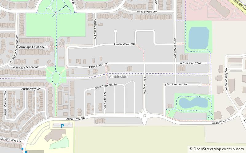
Ambleside, Edmonton
#418 among attractions in Edmonton
Facts and practical information
Southwest Edmonton (Ambleside)Edmonton Canada
Ambleside – popular in the area (distance from the attraction)
Nearby attractions include: Terwillegar Heights, Graydon Hill, Glenridding Ravine, Hays Ridge.
 Neighbourhood
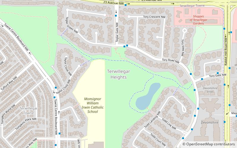
Terwillegar Heights, Edmonton
46 min walk • Terwillegar Heights is a residential area in the southwest portion of the City of Edmonton in Alberta, Canada. It was established in 1992 through Edmonton City Council's adoption of the Terwillegar Heights Servicing Concept Design Brief, which guides the overall development of the area.
 Neighbourhood
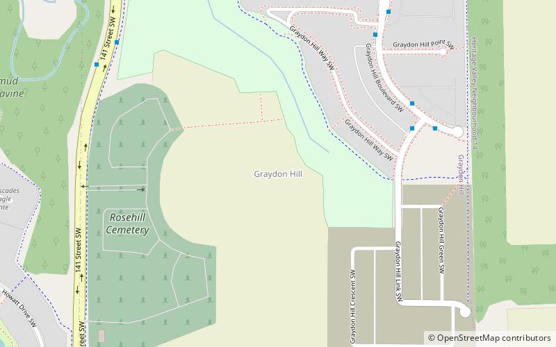
Graydon Hill, Edmonton
45 min walk • Graydon Hill is a future neighbourhood in southwest Edmonton, Alberta, Canada. The neighbourhood is named after Rosetta Graydon, founder of the Edmonton Humane Society, originally the Edmonton Society for the Prevention of Cruelty to Animals. She also played a role in the designation of Edmonton as Alberta's provincial capital.
 Neighbourhood
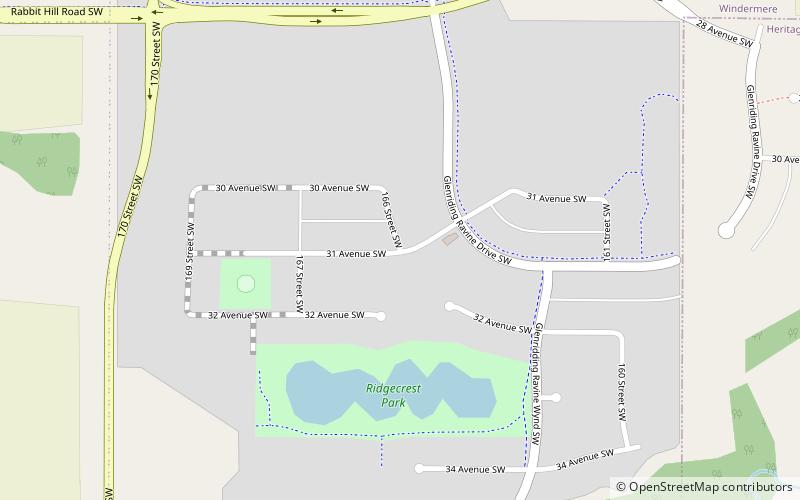
Glenridding Ravine, Edmonton
41 min walk • Glenridding Ravine is a future neighbourhood in southwest Edmonton, Alberta, Canada. Glenridding Ravine is located within the Windermere area and, along with Glenridding Heights, comprised the original Neighbourhood 4 within Windermere Area Structure Plan.
 Neighbourhood
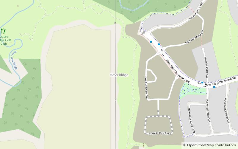
Hays Ridge, Edmonton
33 min walk • Hays Ridge is a neighbourhood that is under development in southwest Edmonton, Alberta, Canada. Subdivision and development of the neighbourhood is being guided by the Hays Ridge Neighbourhood Area Structure Plan, which was adopted by Edmonton City Council on April 16, 2012. The neighbourhood is named after Dr. Helen Hays.
 Neighbourhood
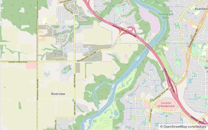
River's Edge, Edmonton
63 min walk • River's Edge, briefly known as River Alder, is a future neighbourhood in west Edmonton, Alberta, Canada. Subdivision and development of the neighbourhood will be guided by the Riverview Neighbourhood 3 Neighbourhood Structure Plan, which was adopted by Edmonton City Council on September 22, 2015.
 Neighbourhood
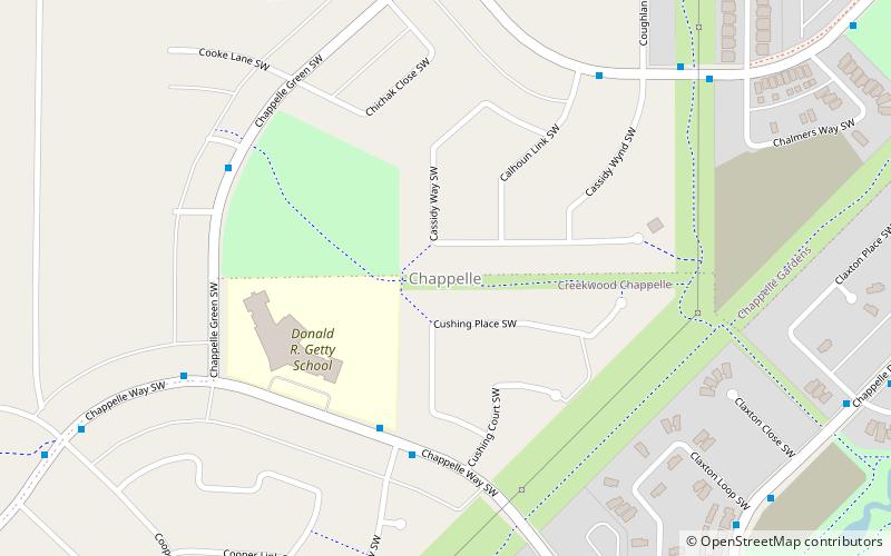
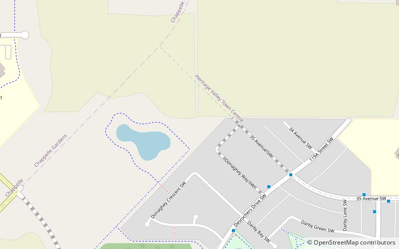
Chappelle, Edmonton
51 min walk • Chappelle is a neighbourhood in southwest Edmonton, Alberta, Canada that was established in 2008 through the adoption of the Chappelle Neighbourhood Area Structure Plan. It is located within Heritage Valley and was originally considered Neighbourhood 10 within the Heritage Valley Servicing Concept Design Brief.
 Neighbourhood
Heritage Valley, Edmonton
62 min walk • Heritage Valley is a residential area in the southwest portion of the City of Edmonton in Alberta, Canada. It was established in 2001 through Edmonton City Council's adoption of the Heritage Valley Servicing Concept Design Brief, which guides the overall development of the area.
 Sport venue, Sport, Arenas and stadiums
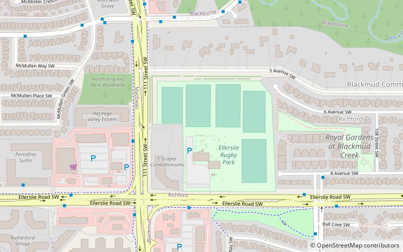
Ellerslie Rugby Park, Edmonton
90 min walk • Ellerslie Rugby Park is a park located in South Edmonton in the neighborhood of Ellerslie. It hosts as the Edmonton Gold's home field and it also puts on many private events. There are two buildings on the site, the Banquet Room, and the Clubroom. It was opened in 1984.
 Neighbourhood
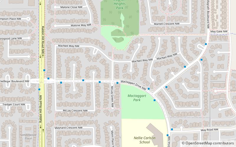
Mactaggart, Edmonton
49 min walk • Mactaggart is a neighbourhood in southwest Edmonton, Alberta, Canada that was established in 2005 through the adoption of the Mactaggart Neighbourhood Area Structure Plan. Mactaggart is located within Terwillegar Heights that was initially planned under the Terwillegar Heights Servicing Concept Design Brief.
 Neighbourhood
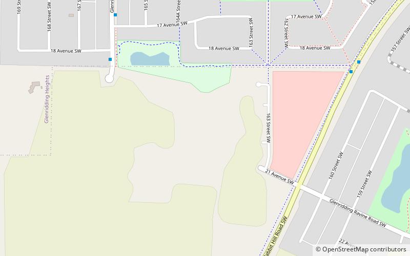
Glenridding Heights, Edmonton
26 min walk • Glenridding Heights is a neighbourhood in southwest Edmonton, Alberta, Canada that was established in 2011 through the adoption of the Glenridding Heights Neighbourhood Structure Plan.
 Neighbourhood
Desrochers, Edmonton
68 min walk • Desrochers is a neighbourhood in southwest Edmonton, Alberta, Canada that was established in 2010 through the adoption of the Desrochers Neighbourhood Area Structure Plan. It is located within Heritage Valley and was originally considered Neighbourhood 9 within the Heritage Valley Servicing Concept Design Brief.